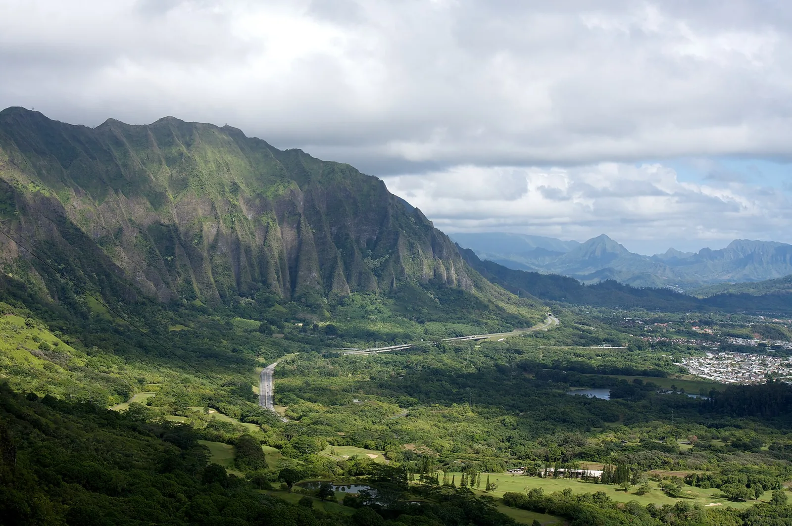
At the head of Nuʻuanu Valley, 1,186 feet up, the Koʻolau mountains break open and the whole windward coast appears at once: Kāneʻohe Bay, Kailua, a chain of islets, and cliffs that drop roughly 1,000 feet beneath your feet. The Nuuanu Pali Lookout is also where, in 1795, the battle that won Oʻahu for Kamehameha ended with hundreds of warriors driven over the edge. It’s a view and a history lesson in one, and usually it costs $7 to park.
Usually. The lookout and Pali Lookout Road were closed on 7 September 2026 when Hurricane Lowell passed, and when we checked in early October no reopening had been announced. So here’s everything you need for when it reopens, how to check whether it has, and twelve other Oʻahu lookouts, most of them free, to enjoy in the meantime.
Nuuanu Pali Lookout: Status, Hours and Fees
| What | Details |
|---|---|
| Current status | Closed with Pali Lookout Road since 7 September 2026 after Hurricane Lowell; no reopening announced as of early October 2026 |
| Normal hours | 06:00–18:00 daily |
| Cost | $7 per car for non-residents; no per-person entry fee |
| Where | Off the Pali Highway (Route 61), about five miles north-east of downtown Honolulu |
| Elevation | 1,186 feet, below peaks of around 3,000 feet |
| Getting there | By car or tour; there’s no bus stop at the lookout |
| Allow | 20–45 minutes |
Before you drive up, check the Division of State Parks’ Nuʻuanu Pali State Wayside page, which posts closures and reopenings. The Pali Highway itself, the main road between Honolulu and the windward side, stayed open; it’s the short spur road to the lookout and the lookout itself that closed. Once it reopens, expect the usual pattern: a pay station for the $7 non-resident parking fee, free entry for Hawaiʻi residents, and a busy car park from mid-morning, when tour coaches arrive. Closures like this one are a good reason to keep a day of any trip flexible; our guide to planning a trip to Hawaiʻi explains how.
What You See From the Pali
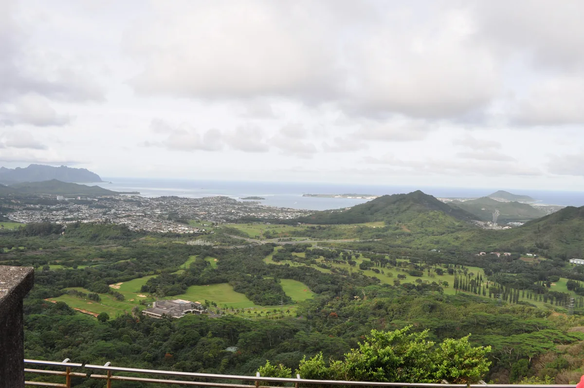
The lookout sits in a notch in the Koʻolau, the mountain range that runs down Oʻahu’s eastern side, and faces north-east over the windward coast. To your left, the cliffs run away in fluted green ridges towards Kāneʻohe. Straight ahead, the towns of Kāneʻohe and Kailua spread across the coastal plain, with the Mōkapu Peninsula and its Marine Corps base jutting into the sea between them. Kāneʻohe Bay glitters to the north, with the little conical islet of Mokoliʻi far beyond, and to the right rise the three peaks of Olomana.
The colours change with the weather. On a clear morning the bay is a dozen shades of blue; on a showery afternoon, clouds pour through the pass at eye level and rainbows hang over the valley. Both are worth seeing.
The Battle of Nuʻuanu, 1795
In 1795, Kamehameha I sailed from Hawaiʻi Island with an army of around 10,000 warriors, a handful of foreign advisers among them, landed on Oʻahu’s south shore and marched inland against Kalanikūpule, Oʻahu’s ruling chief. The defenders fell back up Nuʻuanu Valley, fighting as they went, until they reached the head of the valley, where the land ends in a sheer drop. Caught between Kamehameha’s army and the cliff, more than 700 Oʻahu warriors jumped or were forced over the edge. Kalanikūpule escaped into the mountains but was later captured.
The victory gave Kamehameha Oʻahu, and with it the momentum to unite all the islands into a single kingdom by 1810. A century later, in 1897, workers building the Old Pali Road found more than 800 skulls near the base of the cliffs. Many Hawaiians still regard the Pali as a place of mourning, so treat it as you would any battlefield or grave: quietly, and taking nothing away. Our guide to Hawaiian culture and history tells the larger story of Kamehameha’s kingdom.
From Footpath to Highway: Crossing the Pali
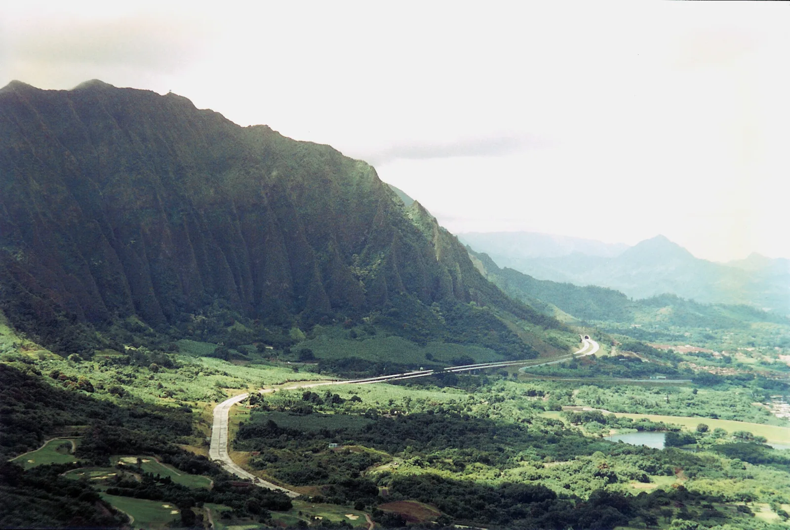
For centuries the only way between Honolulu and the windward side was a narrow foot trail that climbed Nuʻuanu Valley and zigzagged down the face of the cliffs, a route Hawaiians used for trade, travel and war. In the 19th century it was widened into a rough horse trail, and in 1897 and 1898 the Old Pali Road was blasted and paved down the cliff face in a series of hairpins, the work that uncovered the bones of the 1795 battle. In the 1950s, tunnels and the modern Pali Highway took over, leaving the old road to walkers below the lookout.
That layered history is part of the view. Standing at the wall, you can trace the line of the old road below, hear the highway traffic in the tunnels beside you and look out over the land Kamehameha’s army fought for.
Legends of the Pali
Few places on Oʻahu carry as many stories. The best known is the one about pork: because of the old feud between Pele, the volcano goddess, and Kamapuaʻa, the pig demigod, you’re never supposed to carry pork over the Pali, especially at night, or your car may stall until you throw it out. Nuʻuanu Valley is also one of the places where people speak of the huakaʻi pō, the night marchers, ghostly processions of ancient warriors. Locals tell these stories with varying degrees of seriousness. Listen with respect, and don’t treat them as a joke in front of the people telling them.
When to Visit
When the lookout reopens, the first hour after the 6am opening is the best: the air is usually at its clearest, the car park is quiet, and the low sun lights up the windward cliffs. By mid-morning, circle-island coaches arrive and the viewing platform fills. Afternoons bring more cloud and passing showers, which hide the view one minute and hang a rainbow over the valley the next; if it’s socked in when you arrive, wait ten minutes, as it often clears.
The trade winds blow most of the year, so expect wind whenever you go, and expect the windward side to be greener and wetter than Waikīkī. Winter brings more frequent showers; summer tends to be clearer and windier. Our guide to the best time to visit Hawaiʻi covers the seasons across the island.
If the Pali Is Still Closed: Windward Views Instead
You can still get the windward panorama without the Pali. From the Pali Highway itself the view opens up as you come out of the tunnels, but there’s nowhere to stop safely, so let a passenger enjoy it. Better options:
- Hoʻomaluhia Botanical Garden in Kāneʻohe puts you right at the foot of the same Koʻolau cliffs, free, from 9am to 4pm (closed Thursdays).
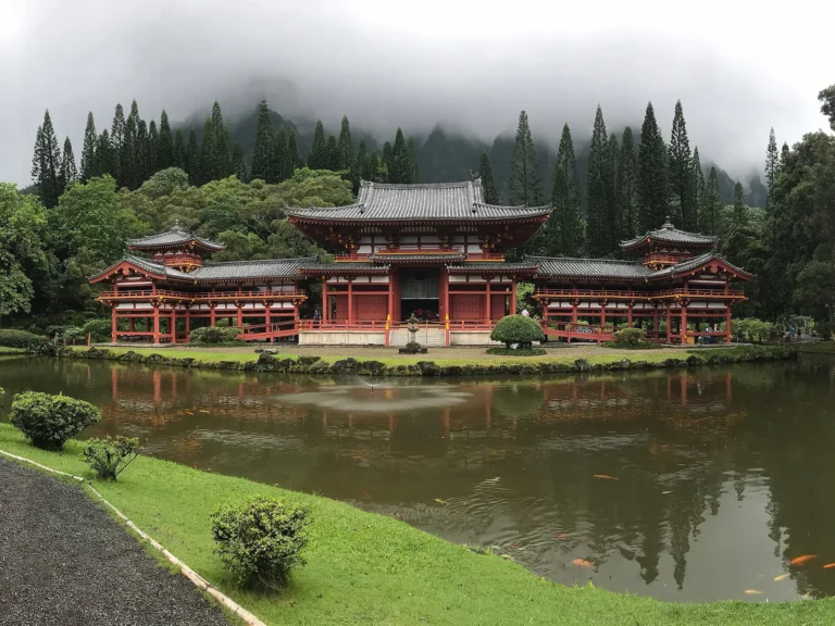
- Byodo-In Temple, nearby in the Valley of the Temples, frames its red temple against the cliffs for $10, from 8:30am to 4:30pm.
- The Lanikai Pillbox gives you the coast from above at sunrise, free.
- Kualoa Regional Park looks up at the jagged Kualoa ridge and out to Mokoliʻi from a free beach park on Route 60.
- The Makapuʻu Lighthouse Trail shows the whole windward coast running north from the island’s eastern tip.
- A full windward day, strung together in our Oʻahu itinerary, covers most of these in one loop.
Getting to the Pali
From Waikīkī or downtown, take the Pali Highway (Route 61) inland and uphill through Nuʻuanu Valley; the turn-off for the lookout is signposted just before the tunnels at the top. The drive from downtown is about five miles. TheBus runs over the Pali Highway, Route 67 between Ala Moana and Kailua among others, but doesn’t stop at the lookout, so it’s a car, a taxi or a tour. Many circle-island tours from Waikīkī include a stop when the lookout is open; our roundup of Oʻahu tours compares them.
Combine it with the windward side: drive over the Pali to the beaches of Kailua and Lanikai, two of the best beaches in Oʻahu, or loop back through the Likelike Highway past Kāneʻohe. If you’re heading the other way, Queen Emma Summer Palace sits on the Pali Highway in lower Nuʻuanu, open Wednesday to Saturday from 10am to 3:30pm for $20, and it makes a natural stop on the same drive. Our guide to getting around Oʻahu covers car hire and parking.
Visiting the Nuuanu Pali Lookout: Tips
- Hold on to your hat. The trade winds funnel through the pass and gusts can be strong enough to snatch sunglasses, maps and phones. Keep a firm grip on anything light, and on small children.
- Bring a layer. It’s cooler up here than in Waikīkī and often showery, especially in the afternoon.
- Go early or late. The first hour after opening is the calmest, with fewer coaches and the clearest air; the light on the windward cliffs is lovely in the morning.
- Lock up and take valuables with you. Like scenic car parks everywhere, the lookout has a history of car break-ins; leave nothing on show.
- Stay behind the walls. The cliffs are sheer and unstable, and the trails along the ridges from here, including the Pali notches, are dangerous. They are not hikes for visitors.
- Know the old road. Below the lookout, a stretch of the Old Pali Road, closed to cars, makes a short walk with a different angle on the cliffs when the site is open. Don’t use it to reach Maunawili Falls, whose neighbourhood trailhead has been closed since July 2021.
- Mind the pork. An old Hawaiian story says you should never carry pork over the Pali, because of the feud between Pele and the pig god Kamapuaʻa. Locals tell it with a smile, and many still won’t risk it.
With Children, Older Visitors and Wheelchairs
The Pali is one of the most accessible big views on Oʻahu: from the car park it’s a short walk on a paved path to the viewing area, with no climbing involved. The wind is the main hazard. Keep small children by the hand at the wall, zip up anything that might blow away, and expect gusts strong enough to unsettle anyone unsteady on their feet. For families, the lookout pairs well with the gardens at Hoʻomaluhia and the beach at Kailua; our guide to Hawaiʻi with kids has more ideas.
Respecting the Pali
This is a battlefield and, for many Hawaiians, a place where ancestors died, so the usual rules matter more here than at most viewpoints. Stay behind the walls and out of any closed or fenced area; kapu means do not enter. Don’t throw anything over the edge, don’t stack or take rocks, and leave any offerings you see where they are. Keep voices down if others are there to remember rather than sightsee.
Oʻahu’s Best Lookouts and Scenic Viewpoints
Whether or not the Pali has reopened when you visit, these twelve viewpoints cover the island, from roadside pull-offs to summits you have to earn. For more walks with views, see our guide to the best hikes on Oʻahu.
At a glance, here’s how they compare:
| Lookout | Best for | Cost | Effort |
|---|---|---|---|
| Nuʻuanu Pali | Windward coast and history | $7 parking (closed after Lowell) | Car park |
| Puʻu ʻUalakaʻa | Sunset over Honolulu | $7 parking | Car park |
| Diamond Head | Waikīkī from above | $5 per person + $10 per car | 1.5–2-hour hike |
| Makapuʻu Lighthouse Trail | Whales and the east coast | Free | 2 miles, paved |
| Makapuʻu Lookout | Rabbit Island and the bay | Free | Roadside |
| Hālona Blowhole | The blowhole | Free | Roadside |
| Lānaʻi Lookout | Waves and neighbour islands | Free | Roadside |
| Lanikai Pillbox | Sunrise over the Mokulua | Free | Steep, 1.8 miles |
| Kuliʻouʻou Ridge | A Koʻolau summit | Free | 4.8 miles, 1,633 ft |
| Koko Crater | Hanauma Bay and Hawaiʻi Kai | Free | About 1,048 steps |
| Punchbowl | Downtown Honolulu | Free | Short walk |
| Lāʻie Point | The sea arch | Free | Roadside |
| Puʻu o Mahuka Heiau | The North Shore | Free | Short walk |
1. Puʻu ʻUalakaʻa (Tantalus)
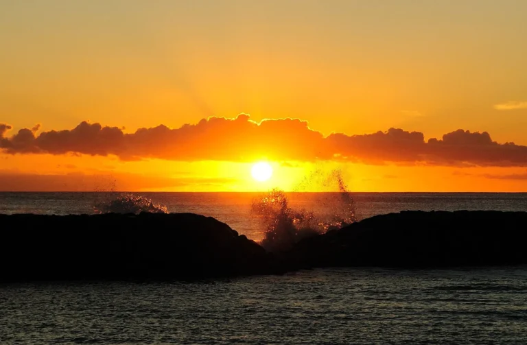
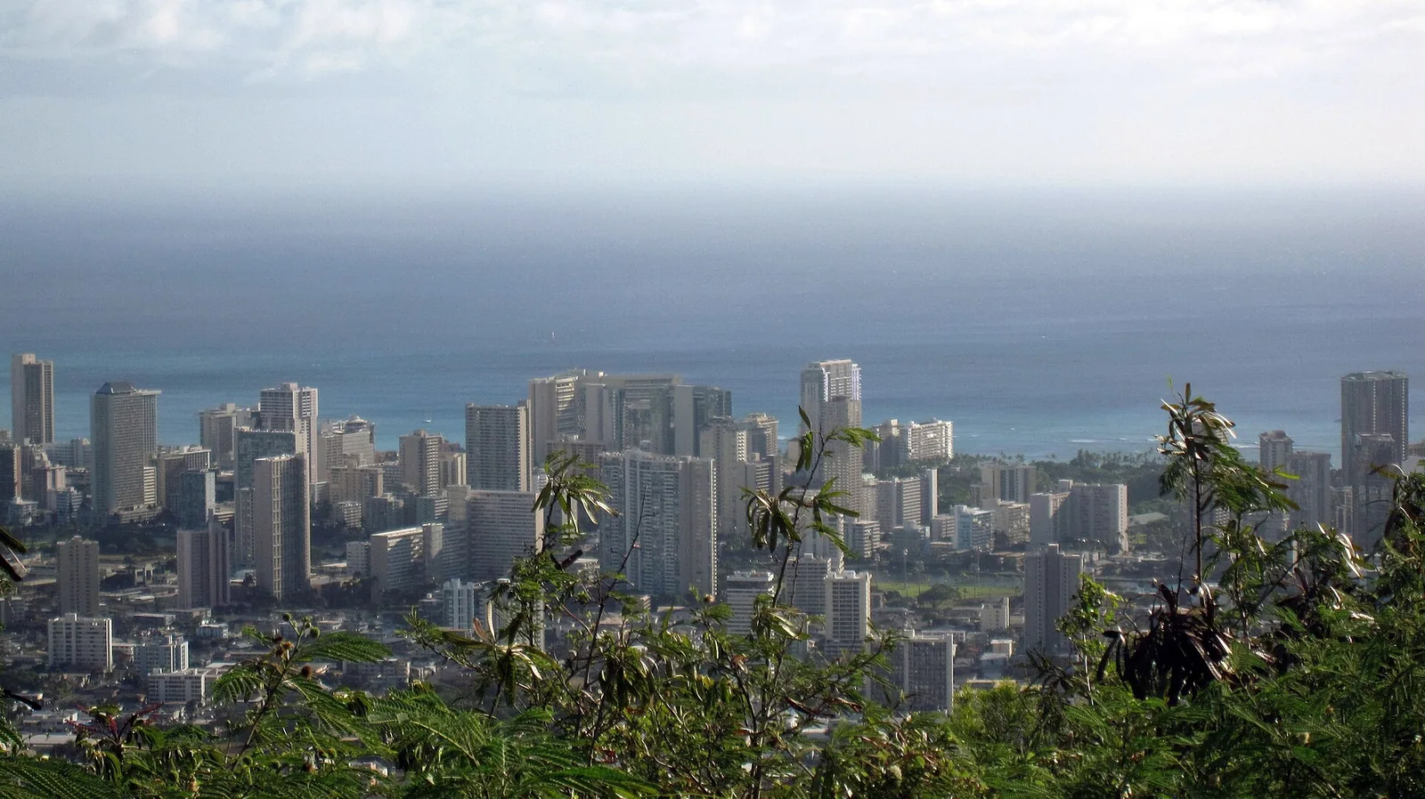
Up the switchbacks of Round Top Drive, this state wayside looks over all of Honolulu, from Diamond Head to Pearl Harbor, and it’s the best sunset lookout on the island. Until 31 March the gate closes at 6:45pm, which catches the sun going down; from 1 April it stays open until 7:45pm.
Cost: $7 parking for non-residents · Hours: 07:00–18:45 until 31 Mar, 07:00–19:45 from 1 Apr · Allow: 45 minutes
2. Diamond Head summit
The classic view down Waikīkī, earned with a 0.8-mile climb and 560 feet of ascent through a tunnel and up two staircases. You need a reservation, made up to 30 days ahead, and the first slot at 6am has the best light. Our Diamond Head hike guide covers the booking system.
Cost: $5 per out-of-state person, $10 per car · Hours: 06:00–18:00, last slot 16:00 · Allow: 2 hours
3. Makapuʻu Lighthouse Trail
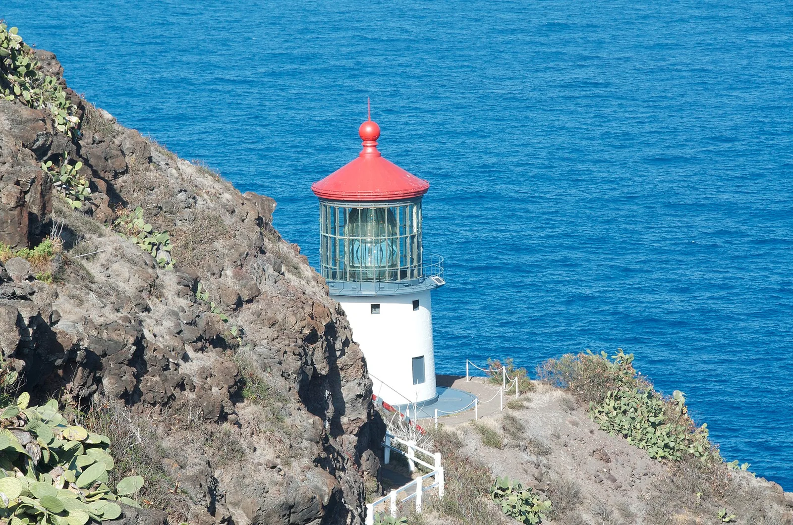
A paved two-mile round trip with about 500 feet of climb to the red-roofed lighthouse above Oʻahu’s eastern tip, with the windward coast unrolling to the north and, from December to May, humpback whales below. There’s no shade; go early.
Cost: free · Allow: 1.5 hours
4. Makapuʻu Lookout
Just past the lighthouse trailhead, a roadside lookout above Makapuʻu Beach looks straight down on the turquoise bay and out to Mānana, often called Rabbit Island, and the smaller Kāohikaipu, both seabird sanctuaries. It’s a five-minute stop with one of the best views on the coast. The shorebreak at the beach below is for expert bodysurfers only.
Cost: free · Allow: 15 minutes
5. Hālona Blowhole
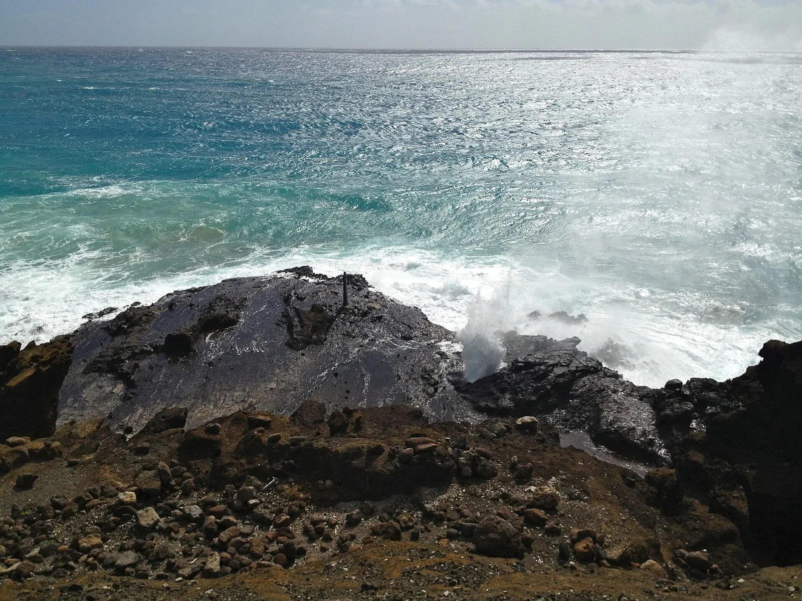
Swells shoot through a lava tube in a plume of spray beside the highway, with a tiny cove below and whales offshore in winter. Stay behind the railings: people have died climbing down to the blowhole.
Cost: free · Allow: 15 minutes
6. Lānaʻi Lookout
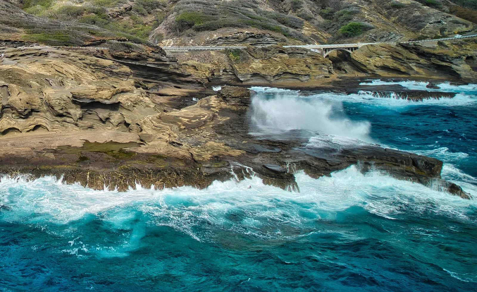
Between Hanauma Bay and Hālona, a roadside pull-off overlooks layered cliffs of volcanic tuff where waves explode on the ledges below. On a clear day you can see Molokaʻi and Lānaʻi across the channel, which is how it got its name. Stay on the upper level: waves regularly sweep the lower ledges.
Cost: free · Allow: 15 minutes
7. Lanikai Pillbox
A steep, short scramble, about 1.8 miles round trip, to old military bunkers on Kaʻiwa Ridge, looking down on Lanikai’s turquoise water and the twin Mokulua islets. It’s at its best at sunrise. Parking is banned along Mokulua and Aʻalapapa Drives, so park at Kailua Beach Park.
Cost: free · Bus: 67 to Kailua · Allow: 1.5 hours
8. Kuliʻouʻou Ridge
A forest trail climbs to the spine of the Koʻolau, where you look straight down on Waimānalo and the windward coast. It’s 4.8 miles round trip with 1,633 feet of climbing: the hardest view on this list, and one of the best. Turn back if the ridge clouds over.
Cost: free · Allow: 3–3.5 hours
9. Koko Crater summit
About 1,048 old railway steps straight up the side of Koko Crater lead to a summit view over Hanauma Bay, Hawaiʻi Kai and Diamond Head. It’s brutal and shadeless, so go at sunrise.
Cost: free; two free lots in Koko Head District Park · Hours: sunrise–sunset · Allow: 1.5 hours
10. Punchbowl’s rim
Inside Puowaina crater, the National Memorial Cemetery of the Pacific has a lookout at its rim with a fine view over downtown Honolulu to the harbour. Visit the memorial first, and keep your voice down; this is a working cemetery, where many who died in the Pacific war, including at Pearl Harbor, are buried.
Cost: free · Hours: 08:00–18:00 daily · Allow: 1 hour
11. Lāʻie Point State Wayside
On the north-east shore, a small headland at the end of a residential street looks out at a sea arch and seabird islets, with waves crashing on the rocks on big days. There are no facilities and very little parking, so stop briefly and quietly.
Cost: free · Bus: Route 60 to Lāʻie · Allow: 20 minutes
12. Puʻu o Mahuka Heiau
On a bluff above Waimea Bay, the largest heiau on Oʻahu has a sweeping view along the North Shore. It remains a sacred site: stay outside the walls and leave offerings undisturbed. Our North Shore guide covers the coast below.
Cost: free · Hours: 09:00–17:00 daily · Allow: 45 minutes
Photography Tips
The Pali’s view is huge, so a wide angle helps; on a phone, use the wide lens or a panorama, sweeping slowly from the cliffs on the left to Olomana on the right. Morning light falls on the windward cliffs and brings out their ridges; by afternoon they’re often in shadow or cloud. The wind makes tripods wobble and can knock a phone out of your hand, so brace against the wall. For rainbows, come in the showery late morning or afternoon and keep the sun behind you. At the other lookouts, the same rules apply: east-facing spots like Makapuʻu and Lanikai shine at sunrise, west-facing Puʻu ʻUalakaʻa at sunset.
A Lookout Day on Oʻahu
With a car, you can string the best viewpoints into one day, starting with the sunrise on the east side and ending with the sunset over the city:
- Sunrise: Lanikai Pillbox or the Makapuʻu Lighthouse Trail, both facing the rising sun.
- Morning: the coastal pull-offs at Makapuʻu Lookout, Hālona Blowhole and Lānaʻi Lookout, then breakfast in Hawaiʻi Kai or Kailua; our guide to the best restaurants in Honolulu covers both.
- Midday: the Nuʻuanu Pali Lookout, if it has reopened, on the drive back to town; if not, Queen Emma Summer Palace in Nuʻuanu (Wednesday to Saturday).
- Afternoon: Punchbowl’s rim and the memorial.
- Sunset: Puʻu ʻUalakaʻa on Tantalus, before the gate closes.
Free lookouts like these feature in our list of free things to do on Oʻahu, and quieter ones in our guide to Oʻahu’s hidden gems. For the island’s headline sights, start with things to do in Oʻahu, and for the city’s, the 40 best things to do in Honolulu.
Planning paid attractions for the rest of your trip? Our guide to whether the Go Oʻahu Card is worth it sets Go City’s passes against 2026 gate prices, attraction by attraction.
Frequently Asked Questions
Is the Nuuanu Pali Lookout open?
It was closed, along with Pali Lookout Road, on 7 September 2026 after Hurricane Lowell, and no reopening had been announced when we checked in early October 2026. The Pali Highway itself remained open. Check the Division of State Parks’ page for the Nuʻuanu Pali State Wayside before you drive up. When open, it runs from 6am to 6pm daily.
How much does the Pali Lookout cost?
There’s no per-person entry fee. Non-residents pay $7 to park a car, and Hawaiʻi residents park free. If you visit on a circle-island tour, the stop is included in the tour price. Most other lookouts on Oʻahu are free, apart from Puʻu ʻUalakaʻa, which also charges non-residents $7 to park, and Diamond Head.
Can you take the bus to the Pali Lookout?
No. TheBus runs over the Pali Highway, including Route 67 between Ala Moana and Kailua, but doesn’t stop at the lookout. You’ll need a car, a taxi or a tour. Many circle-island tours from Waikīkī stop at the Pali when it’s open, which is the easiest way to visit without driving.
Why is the Pali Lookout so windy?
The lookout sits in a gap in the Koʻolau mountains, and the north-easterly trade winds that blow across the windward coast are squeezed through the pass, speeding up as they go. On a typical day the gusts are strong enough to snatch hats and sunglasses. Hold on to children and anything light, and bring a layer.
What happened at the Pali Lookout?
It’s where the Battle of Nuʻuanu ended in 1795. Kamehameha I’s army of around 10,000 drove Oʻahu’s defenders up Nuʻuanu Valley to the cliffs, where more than 700 warriors jumped or were forced over the edge. The victory won Kamehameha Oʻahu. In 1897, road builders found more than 800 skulls at the foot of the cliffs.
What is the best lookout on Oʻahu for sunset?
Puʻu ʻUalakaʻa, on Round Top Drive above Honolulu, looks west over the city and the ocean, and its gate stays open until 6:45pm in winter and 7:45pm from April. For sunrise, head to the east side: the Lanikai Pillbox and the Makapuʻu Lighthouse Trail both face the rising sun.
Is the Pali Lookout worth visiting?
Yes, when it’s open. It’s the easiest big view on Oʻahu, a short drive from downtown with almost no walking, and its history makes it one of the island’s most significant places. It’s crowded from mid-morning and often windy and showery, so go early. If it’s still closed after Hurricane Lowell, Makapuʻu or Lanikai give a similar windward panorama.
How long do you need at the Pali Lookout?
Most visitors spend 20 to 45 minutes: long enough to take in the view, read the history panels and take photographs. Add half an hour to walk a stretch of the Old Pali Road below the lookout when the site is open. The drive from downtown Honolulu up the Pali Highway is about five miles.
Photo Credits
- Koʻolau cliffs from the Pali: Lukas from Tokyo, Japan, CC BY 2.0
- View from the Pali Lookout: InSapphoWeTrust from Los Angeles, California, USA, CC BY-SA 2.0
- Nuʻuanu Pali: Holly Cheng, CC BY-SA 3.0
- Honolulu from Puʻu ʻUalakaʻa: The Eloquent Peasant, CC BY-SA 4.0
- Makapuʻu Point Lighthouse: Pete Markham, CC BY-SA 2.0
- Hālona Blowhole: Daniel Ramirez, CC BY 2.0
- Lānaʻi Lookout: Eric Tessmer, CC BY 4.0