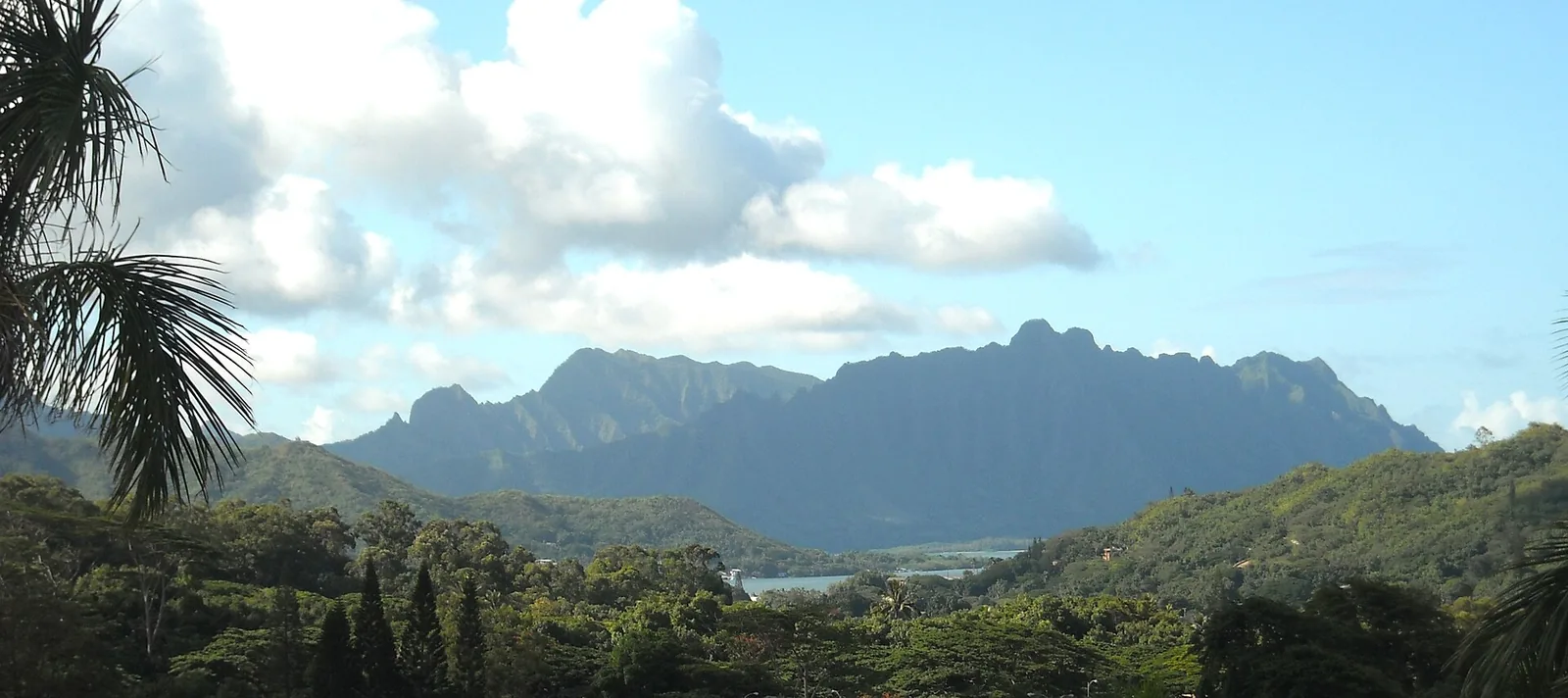
Stand at the top of Kuliʻouʻou Ridge on a clear morning and the whole windward coast lies below you, from Waimānalo’s long beach to Rabbit Island, with the wind coming straight up the cliff. Two hours earlier you were parking on a quiet street in suburban East Honolulu. That closeness is what makes the best hikes on oahu so good, and also what gets people into trouble: trails that start behind houses climb onto narrow, crumbling ridges, cross streams that can flood in minutes, and end at cliffs where the only safe move is to turn round.
This guide covers more than 25 trails, with distance, elevation gain, time, a difficulty rating calibrated to ordinary visitor fitness, and a legal-status column, because a surprising number of Oʻahu hikes that still circulate online are closed, restricted or simply illegal. Distances and elevation gains are approximate round-trip figures; GPS apps disagree by 10 to 20 per cent, and ridge trails always feel longer than the number says.
A current note first. After Hurricane Lowell on 7–8 September 2026, most state parks on Oʻahu reopened within days, but some areas remain shut. The Keawaʻula section of Kaʻena Point State Park has only partly reopened, to the comfort-station car park, and the Keawaʻula trail is still closed. The Nuʻuanu Pali Lookout and its access road were closed until further notice, and Farrington Highway had closures in Nānākuli and Mākaha. Check the DLNR trail closure alerts and the state’s Nā Ala Hele trail site before any hike this month.
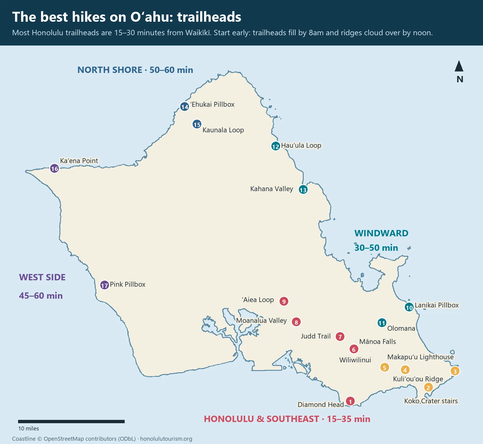
The best hikes on Oahu at a glance
Before the table, the difficulty scale, because “moderate” on a hiking app often means something quite different to a visitor who walks mainly on pavement.
- Easy: a reasonably active adult in trainers, including older children, with rest stops. Paved or well-graded path, little exposure.
- Moderate: someone who walks for an hour or more regularly. Sustained uphill sections, roots, rocks and mud, shoes with real grip.
- Hard: fit hikers only. Steep, sustained climbing for two hours or more, narrow ridges, slippery clay, sometimes fixed ropes. Proper hiking shoes and plenty of water.
- Expert: exposed ridge scrambling where a slip can be fatal. Not for visitors without serious mountain experience, and not in wet or windy weather for anyone.
| Trail | Area | Distance (RT) | Gain | Time | Difficulty | Legal status |
|---|---|---|---|---|---|---|
| Diamond Head Summit | Honolulu | 1.6 mi | 560 ft | 1.5–2 h | Easy–moderate | Open, reservation required |
| Makapuʻu Point Lighthouse | Southeast | 2 mi | 500 ft | 1–1.5 h | Easy | Open |
| Koko Crater Railway (stairs) | Southeast | 1.6 mi | About 1,000 ft | 1–2 h | Hard (short) | Open, free |
| Mānoa Falls | Honolulu | 1.6 mi | About 600 ft | 1–1.5 h | Easy–moderate | Open, paid parking |
| Lanikai Pillbox (Kaʻiwa Ridge) | Windward | 1.8 mi | About 600 ft | 1–1.5 h | Moderate | Open; street parking banned nearby |
| Kuliʻouʻou Ridge | Southeast | 4.8 mi | 1,633 ft | 3–3.5 h | Hard | Open |
| Wiliwilinui Ridge | Southeast | 4.9 mi | 1,597 ft | 3–3.5 h | Hard | Open, gated-community access |
| Mariner’s Ridge | Southeast | About 2.5 mi | About 700 ft | 1.5–2 h | Moderate | Open |
| Koko Crater Botanical Garden loop | Southeast | About 2 mi | Minimal | 1 h | Easy | Open, free |
| Olomana (first peak) | Windward | About 3.5 mi | About 1,400 ft | 3–4 h | Hard | Open, high risk |
| Olomana (second and third peaks) | Windward | 4.5 mi | About 1,600 ft | 4–5 h | Expert | Open, fatalities recorded |
| ʻAiea Loop | Central | 4.8 mi loop | About 900 ft | 2.5–3 h | Moderate | Open |
| Moanalua Valley | Honolulu | 3–6 mi on the valley floor | Gentle until the final ridge | 2–4 h | Easy–moderate (valley) | Open to the ridge; no descent |
| Judd Trail and Jackass Ginger Pool | Nuʻuanu | 1.1 mi loop | About 200 ft | 1 h | Easy, very muddy | Open |
| Puʻu Pia | Mānoa | About 2 mi | About 500 ft | 1–1.5 h | Easy–moderate | Open |
| Makiki Valley and Tantalus loops | Honolulu | 2.5–6 mi | Varies | 2–4 h | Moderate | Open |
| Waʻahila Ridge | Honolulu | 4–5 mi | About 1,000 ft | 2.5–3 h | Moderate | Open |
| Hauʻula Loop | Windward | 2.5 mi loop | About 600 ft | 1.5–2 h | Moderate | Open |
| Kahana Valley (Nakoa Trail) | Windward | About 4.5 mi loop | Low | 2.5–3 h | Moderate, stream crossings | Open, flood risk |
| ʻEhukai Pillbox | North Shore | About 1.5 mi | About 500 ft | 1 h | Moderate (steep) | Open |
| Kaunala Loop | North Shore | About 5 mi loop | About 700 ft | 3 h | Moderate | Open weekends and state holidays only |
| Waimea Valley path | North Shore | About 1.5 mi, paved | Low | 1–2 h | Easy | Paid entry, $26 |
| Kaʻena Point from Mokulēʻia | North-west | 5 mi | Flat | 2.5–3 h | Easy, very hot | Open; check DLNR |
| Kaʻena Point from Keawaʻula | West | 5 mi | Flat | — | — | Closed after Hurricane Lowell |
| Pink Pillbox (Puʻu o Hulu) | West | About 1.5 mi | About 500 ft | 1 h | Moderate | Open; check road status |
| Hawaiʻiloa Ridge | Southeast | About 5 mi | About 1,600 ft | 3 h | Hard | Restricted: resident and military guests |
| Maunawili Falls | Windward | — | — | — | — | Neighbourhood trailhead closed since 2021 |
| Sacred Falls (Kaluanui) | Windward | — | — | — | — | Closed since 1999; illegal |
| Haʻikū Stairs | Windward | — | — | — | — | Being demolished; illegal |
The easy classics
Diamond Head Summit Trail
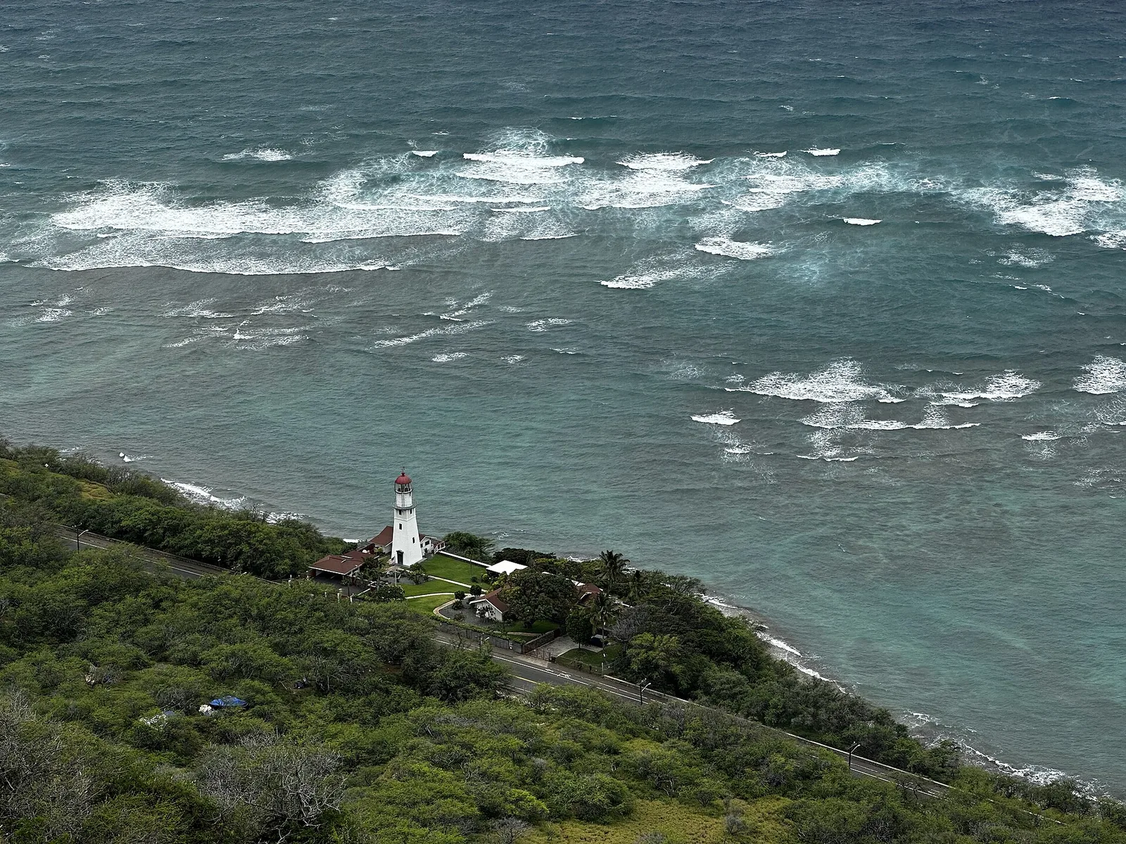
Diamond Head, Lēʻahi in Hawaiian, is a volcanic tuff cone, and the trail climbs from the crater floor to the old Fort Ruger fire-control station on its rim. It is short but steep in places, with switchbacks, a long staircase, a narrow tunnel and a spiral stair inside a concrete bunker. The reward is the classic view along Waikīkī to downtown Honolulu. The first section is paved; the upper half is uneven. There is very little shade, so go early.
Non-residents must reserve an entry time slot, up to 30 days ahead, on the state parks reservation site. There are no walk-ins. Arrive within the first 30 minutes of your slot or you risk being turned away. Afterwards, the plate-lunch window and bakery at Diamond Head Market & Grill on Monsarrat Avenue is a ten-minute drive or a downhill walk; our Honolulu food guide has the details.
Cost: $5 per non-resident plus $10 per vehicle · Hours: 6am–6pm, last entry slot 4pm, must enter by 4:30pm · Book: gostateparks.hawaii.gov, up to 30 days ahead · Bus: Routes 2, 2L and 23 to Diamond Head Road, then walk in through the tunnel · Allow: 2–2.5 hours including the walk from the bus
Makapuʻu Point Lighthouse Trail
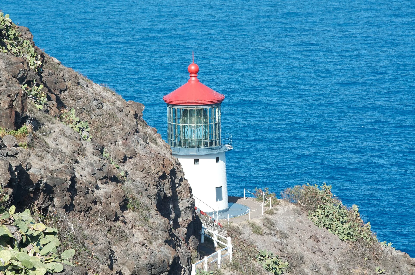
A paved service road climbs gently around the eastern tip of the island to lookouts over the red-roofed Makapuʻu lighthouse, Rabbit Island and the windward cliffs. It is easy underfoot and suitable for pushchairs. It is also one of the best spots on Oʻahu to see humpback whales between December and March, ideally in the early morning. The path is completely exposed and can be brutally hot by 10am, and the wind at the top is strong enough to take a hat. The car park has a long history of break-ins; leave nothing visible.
Cost: free · Hours: daylight · Book: no · Bus: not practical; drive or rideshare · Allow: 30 minutes’ drive from Waikīkī, 1.5 hours on the trail
Mānoa Falls Trail
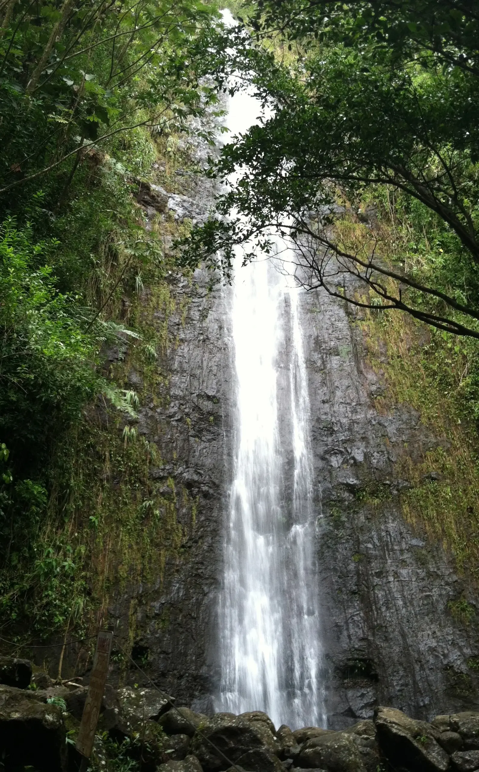
Fifteen minutes from Waikīkī, the Mānoa Falls trail runs up a rainforest valley under giant banyans, bamboo and ginger to a tall, thin waterfall around 150 feet high. The trail is well maintained but often muddy, with roots and rocks near the top. The falls themselves are more modest than photos suggest, particularly in dry spells. Do not swim in the pool or go past the barrier: rockfall happens, and freshwater streams in Hawaiʻi can carry leptospirosis, a bacterial infection that enters through cuts.
Next door, the University of Hawaiʻi’s Lyon Arboretum is open Monday to Friday, 9am to 3pm, with no reservation needed and a suggested $10 donation. It is a good add-on for the same morning.
Cost: free trail; Paradise Park lot about $7 per vehicle · Hours: daylight · Book: no · Bus: Route 5 from Ala Moana Center to upper Mānoa, then a 10–15 minute walk · Allow: 1.5 hours
Koko Crater Botanical Garden and Waimea Valley
Two gentle options for walkers who want scenery without a climb. Inside the Koko Crater cone, a two-mile loop passes through a dryland botanical garden of plumeria, cacti, baobabs and native Hawaiian plants. It is free, quiet and hot. On the North Shore, Waimea Valley’s paved path leads through botanical gardens and archaeological sites to a waterfall. Entry is $26, and the valley is open Tuesday to Sunday, 9am to 4pm. Swimming at the falls is allowed only when lifeguards permit it, decided at 9am each day, and a life jacket is compulsory.
Cost: Koko Crater garden free; Waimea Valley $26 · Hours: Waimea Tue–Sun 9am–4pm · Book: no · Bus: Route 60 for Waimea · Allow: 1–2 hours each
Short, steep and worth it
Koko Crater Railway Trail
This is not really a hike. It is a staircase of about 1,048 old railway sleepers running straight up the side of Koko Crater, the remains of a Second World War tramway built to carry supplies to military bunkers on the summit. Locals use it as a gym. Visitors often underestimate it. About two-thirds of the way up, the track crosses a gap on a short bridge section, where the sleepers have open space underneath; there is a bypass path to the side for anyone uneasy with heights.
The views over Hawaiʻi Kai, Hanauma Bay and the south shore are superb. The descent is harder on the knees than the climb is on the lungs. Take far more water than you think you need, and do not start in the middle of the day: there is no shade at all. The trail is free and needs no reservation, and there are two free car parks inside Koko Head District Park.
Cost: free · Hours: sunrise to sunset · Book: no · Bus: not practical; drive or rideshare · Allow: 25 minutes’ drive from Waikīkī, 1.5–2 hours
Lanikai Pillbox (Kaʻiwa Ridge)
A short, steep climb from the edge of Lanikai onto a dry ridge with Second World War observation bunkers, known as pillboxes, painted and repainted by local artists. From the first pillbox you look down on Lanikai and the Mokulua islets, one of the most photographed views in Hawaiʻi. The first section is loose, eroded dirt that is slippery when dry and treacherous when wet. Most people turn round at the second pillbox. It is best at sunrise, when the sun comes up behind the islets.
The difficulty is parking, not the hike. Parking is banned along Mokulua Drive and ʻAʻalapapa Drive, and cross streets are restricted; enforcement includes tickets and towing. Park free in the boat-ramp lot at Kailua Beach Park and walk about 15–20 minutes to the trailhead. Be quiet on residential streets at dawn.
Cost: free · Hours: daylight; sunrise is most popular · Book: no · Bus: Route 67 from Ala Moana to Kailua, then walk · Allow: 35 minutes’ drive from Waikīkī, 1.5–2 hours including the walk from the car park
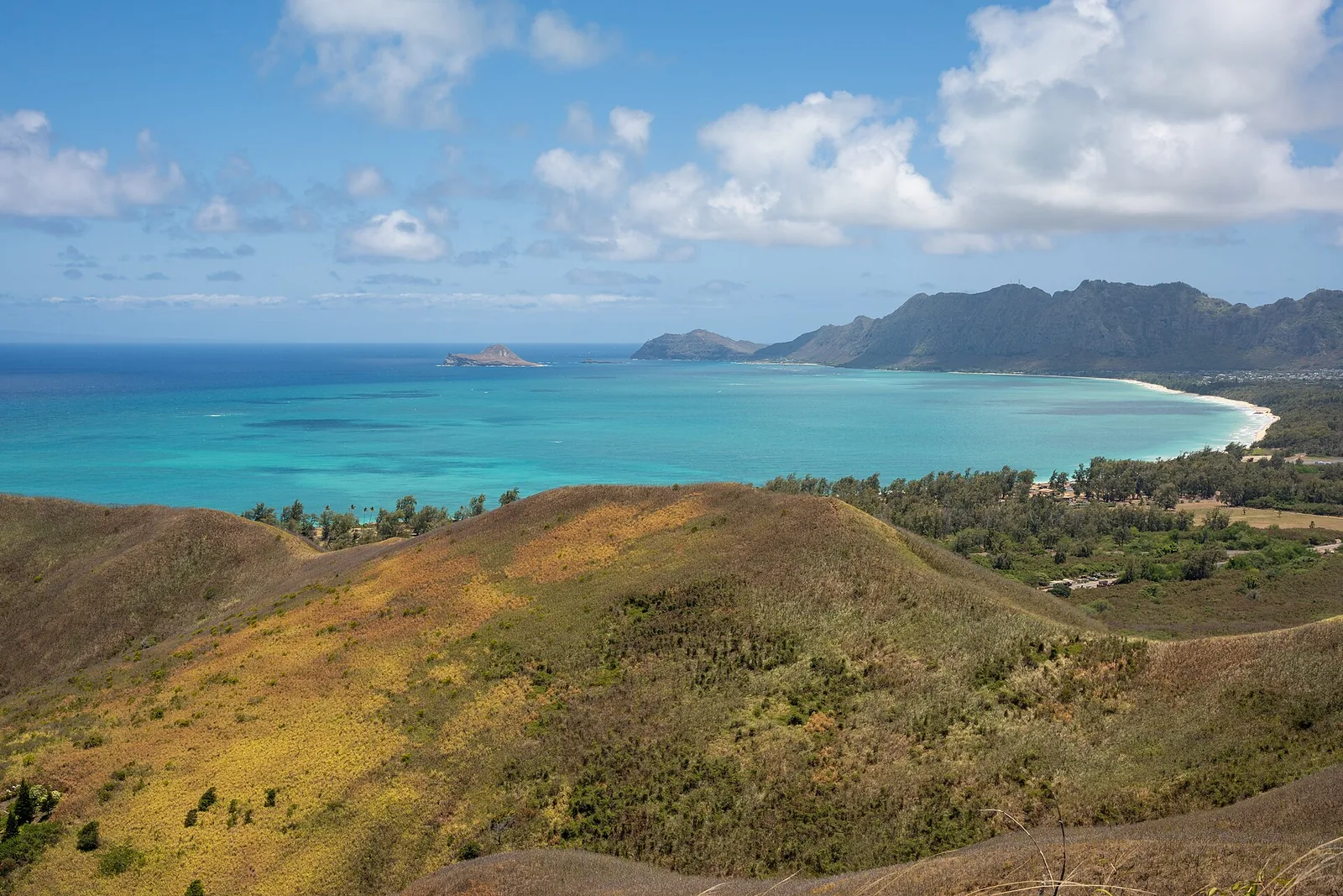
ʻEhukai Pillbox and Pink Pillbox
Two more short pillbox climbs, one on each side of the island. ʻEhukai Pillbox starts beside Sunset Beach Elementary School on the North Shore, climbs steeply through trees and emerges above Sunset Beach and the Banzai Pipeline. In winter it is a free grandstand for the surf. It is short, but the upper section is steep and root-covered.
Pink Pillbox, on Puʻu o Hulu above Māʻili on the west side, is a dry, rocky climb to a bunker painted pink, with sunset views over the Waiʻanae coast. After Hurricane Lowell, Farrington Highway was closed in parts of Nānākuli and Mākaha; check road updates before driving out, and do not leave valuables in the car.
Cost: free · Hours: daylight · Book: no · Bus: Route 60 for ʻEhukai; west side not practical · Allow: 1 hour each, plus 50–60 minutes’ drive from Waikīkī
The best hikes on Oahu for views: the ridge trails
Oʻahu’s great hikes follow the ridges of the Koʻolau Range, which rise from Honolulu’s suburbs to the knife-edge summit crest above the windward coast. The pattern is always similar: a trailhead at the end of a residential street, a climb through introduced forest of strawberry guava and ironwood, then open ridge with native ʻōhiʻa, uluhe fern and views both ways. The last half-mile before the summit is often the steepest, muddiest and most exposed. If clouds are sitting on the crest, the view will be white; if it has rained, the clay will be like ice.
Kuliʻouʻou Ridge
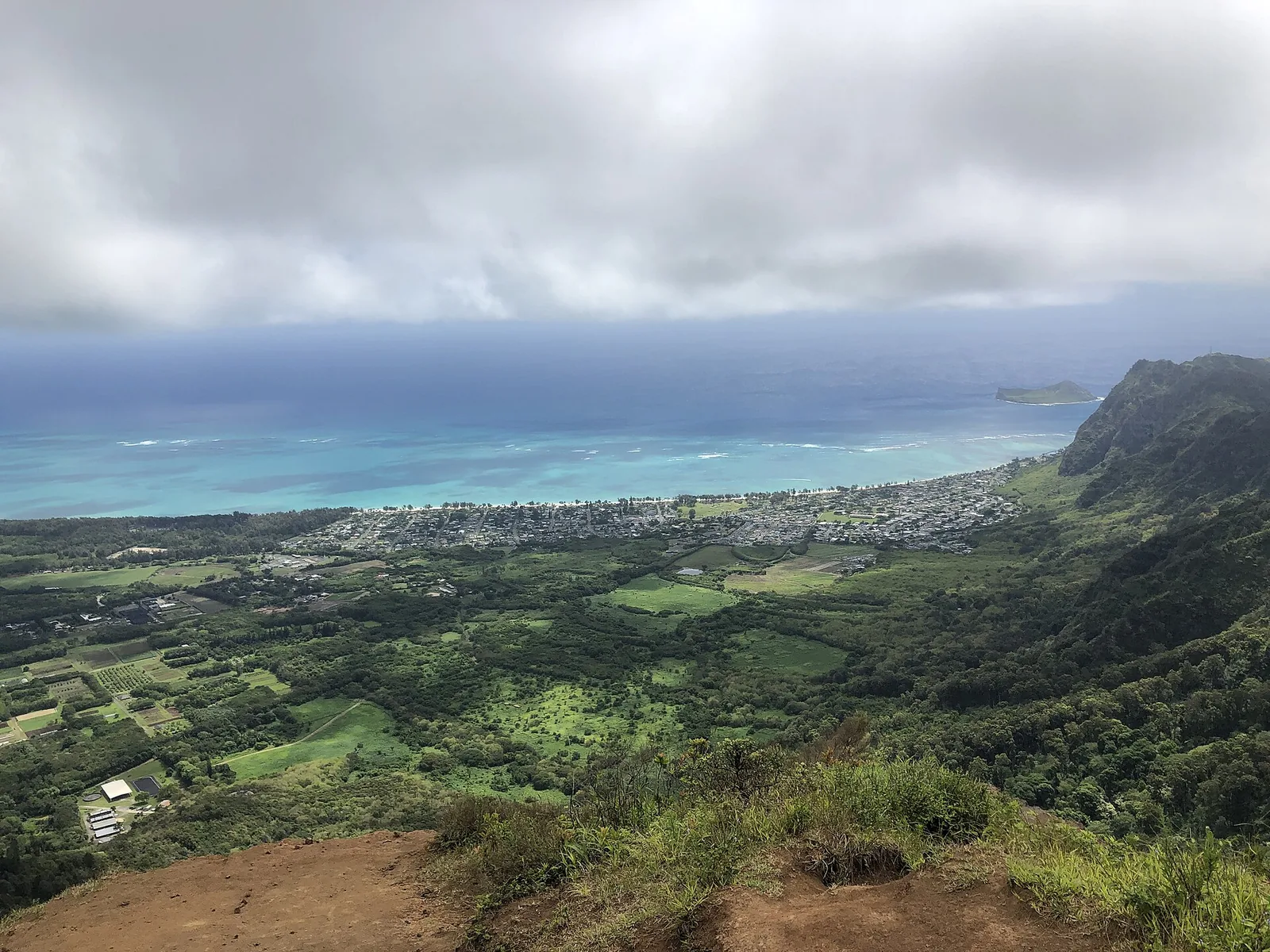
The best all-round ridge hike on Oʻahu for fit visitors. The trail starts at the end of Kalaʻau Place in East Honolulu, climbs through a long series of switchbacks under trees, then follows the open ridge to a summit lookout on the Koʻolau crest. The final section has steps built into the hillside. At the top, the view drops straight down to Waimānalo and across to Rabbit Island and Makapuʻu. The round trip is 4.8 miles with 1,633 feet of gain, and most people take three to three and a half hours.
Park considerately on the residential street, and keep noise down early in the morning. The summit is exposed to wind; carry a light layer. Stay behind the lookout, as the windward side is a sheer drop.
Cost: free · Hours: daylight · Book: no · Bus: not practical · Allow: 25 minutes’ drive from Waikīkī, 3.5–4 hours
Wiliwilinui Ridge
Similar in length and climb to Kuliʻouʻou, at 4.9 miles and 1,597 feet, but with a gentler, wider first half on an old utility road, followed by a steeper final section with steps and ropes. The complication is access. The trailhead sits inside the gated Waiʻalae Iki community; hikers must sign in at the security gate, and a limited number of parking passes are issued. Check the DLNR Nā Ala Hele page for the current procedure before you go, and have photo ID.
Cost: free · Hours: daylight, subject to gate hours · Book: sign in at the gate on the day · Bus: not practical · Allow: 20 minutes’ drive from Waikīkī, 3.5–4 hours
Mariner’s Ridge
A shorter ridge hike in Hawaiʻi Kai that gives a big view for less effort: roughly 2.5 miles round trip to a lookout on the crest over Waimānalo. It starts at the end of a residential street, climbs through ironwoods and becomes steep and rutted near the top. It is a sensible choice if Kuliʻouʻou feels like too much, or if you want a ridge hike finished by mid-morning.
Cost: free · Hours: daylight · Book: no · Bus: not practical · Allow: 2–2.5 hours including the drive
ʻAiea Loop
A 4.8-mile loop from Keaīwa Heiau State Recreation Area above Pearl Harbor, rolling along a forested ridge with views to the Koʻolau and down to Pearl Harbor. It is a moderate, shaded walk rather than a climb, and a good wet-season option because it is lower and less exposed than the summit ridges. Near the far end of the loop, the wreckage of a Second World War military transport plane lies in the gully below the trail. The trail passes Keaīwa Heiau, a healing temple; it is a sacred site, so do not climb on the walls or leave offerings of your own.
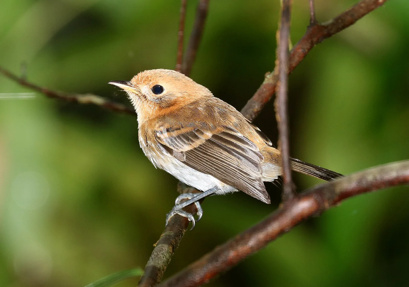
Birdwatchers should look for the Oʻahu ʻelepaio, a small, curious flycatcher found only on this island and listed as endangered.
Cost: free · Hours: daylight; the park gate closes in the evening · Book: no · Bus: not practical · Allow: 30 minutes’ drive from Waikīkī, 3 hours; easy to pair with Pearl Harbor
Olomana
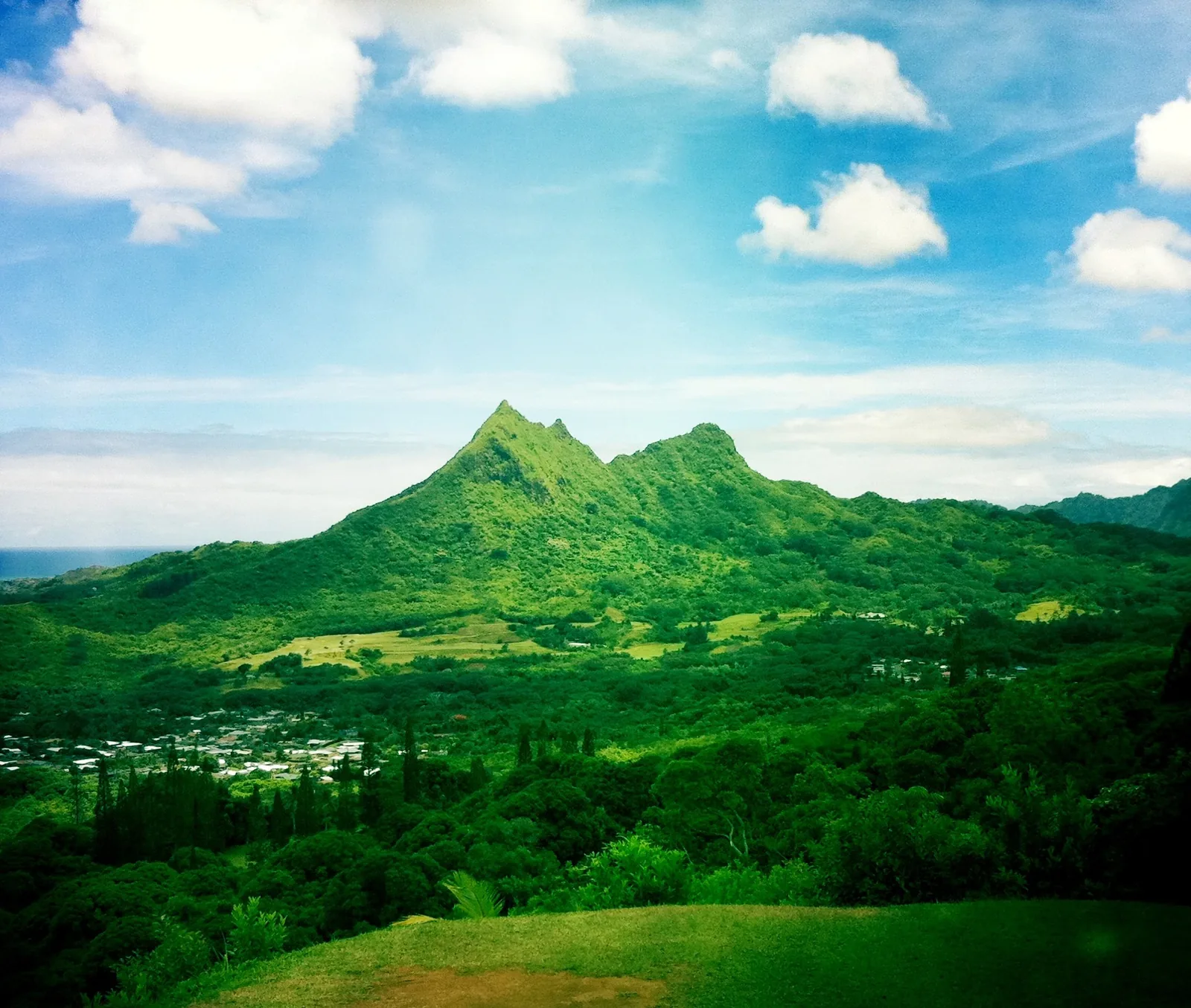
Olomana’s three jagged peaks dominate the view from Kailua, and the hike to them is the most dangerous legal hike on Oʻahu. The first peak involves steep climbing with fixed ropes over rock and root; for most fit hikers, that is the right place to stop. Beyond it, the route to the second and third peaks follows a razor-thin ridge with sheer drops, crumbling rock and short, near-vertical down-climbs. People have died here, including experienced hikers.
Our honest advice: if you are a visitor without real scrambling experience, go to the first peak in dry weather and turn round. Do not attempt any part of the route after rain or in strong wind. Hikers walk in along the Royal Hawaiian Golf Club access road from Auloa Road; park legally outside the gate.
Cost: free · Hours: daylight; start by 7am · Book: no · Bus: not practical · Allow: 35 minutes’ drive from Waikīkī, 3–4 hours to the first peak and back
Valleys, rainforest and waterfalls
Moanalua Valley
A long, gentle walk up a wide, green valley on an old carriage road, crossing a stream several times, past a petroglyph boulder and remnants of the Damon family estate. The first few miles on the valley floor are easy and good for families. The trail eventually climbs steeply to the Koʻolau summit ridge, overlooking Haʻikū Valley and the windward coast.
This is the legal way to see the view that made the Haʻikū Stairs famous. At the top, you will see where people have descended towards the stairs. Do not. The City and County of Honolulu began demolishing the stairs in April 2024, the route is closed, and trespassers face citations and a dangerous, unmaintained descent. Stop at the ridge.
Cost: free · Hours: daylight · Book: no · Bus: not practical; park at Moanalua Valley Neighborhood Park · Allow: 20 minutes’ drive from Waikīkī; 2–3 hours for the valley floor, 6–7 hours to the ridge
Judd Trail and Jackass Ginger Pool
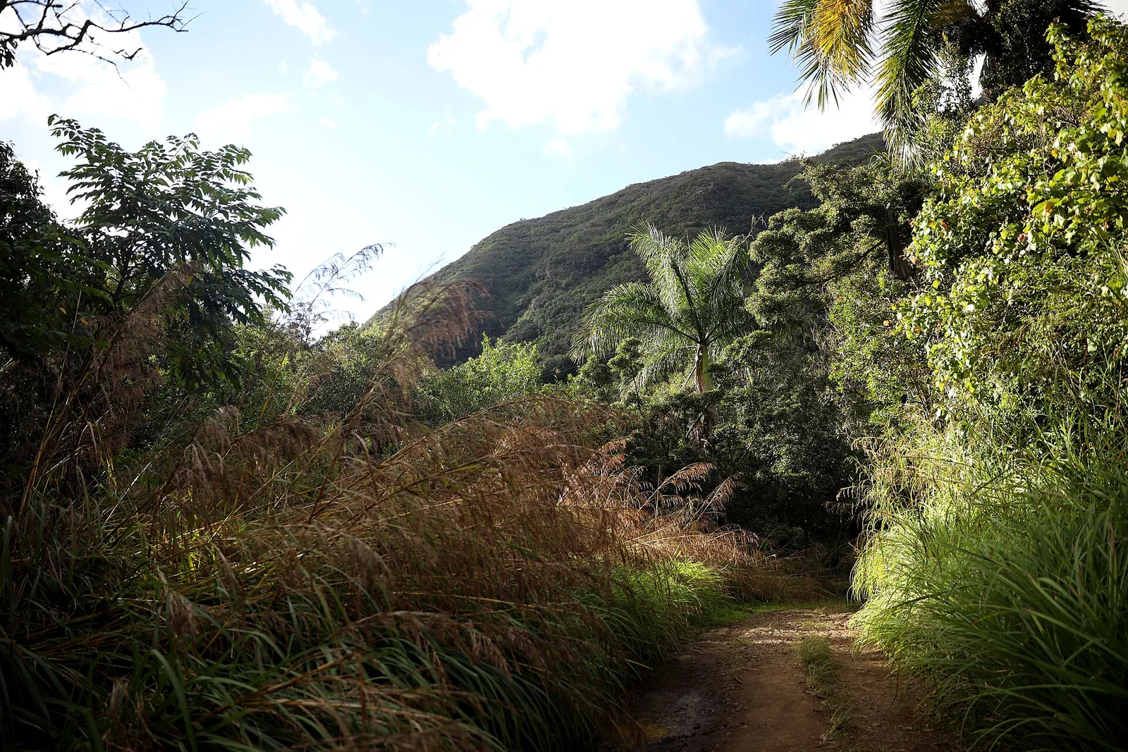
A short loop through bamboo, Norfolk Island pines and ginger in the Nuʻuanu forest, just off the Pali Highway, with a stream crossing and a small swimming hole. It is muddy almost all year, and the roots are slick. The pool is tempting, but the same leptospirosis warning applies: stay out if you have open cuts, and never jump in without checking depth. This is a good, short family outing on a hot day.
Cost: free · Hours: daylight · Book: no · Bus: not practical · Allow: 20 minutes’ drive from Waikīkī, 1–1.5 hours
Tantalus, Makiki and Puʻu Pia
Above Honolulu, the Honolulu Mauka Trail System links a dozen short trails on the forested slopes of Tantalus (Puʻu ʻŌhiʻa), Makiki Valley and Mānoa. You can make loops of 2.5 to 6 miles through bamboo groves and native forest, with city views. Puʻu Pia, at the very top of Mānoa Valley, is a two-mile round trip to a small summit with a view down the valley to Waikīkī. It is one of the best easy hikes close to town, and it is rarely crowded. Waʻahila Ridge, starting from Waʻahila Ridge State Recreation Area above St Louis Heights, is a moderate ridge hike of about four to five miles through Norfolk pines, with a few rocky scrambles.
Cost: free · Hours: daylight · Book: no · Bus: Route 5 for Puʻu Pia · Allow: 1.5–4 hours depending on the loop
Hauʻula Loop and Kahana Valley
Two windward options for a drive up the coast. The Hauʻula Loop climbs through ironwoods and native forest above the coastal town of Hauʻula, with ocean views and ridge-top shade. It is 2.5 miles, moderately steep and usually drier than the Honolulu ridges.
Kahana Valley, inside Ahupuaʻa ʻO Kahana State Park, is one of the wettest valleys on the island, with a loop trail through the forest and several stream crossings. The park is also a living community where Hawaiian families continue to farm and care for the valley. Treat it with respect, stay on marked trails, and do not enter this valley after heavy rain: the stream can rise in minutes.
Cost: free · Hours: daylight · Book: no · Bus: Route 60 along Kamehameha Highway · Allow: 45–60 minutes’ drive from Waikīkī, 2–3 hours each
Kaunala Loop
A shaded forest loop at the top of Pūpūkea Road above the North Shore, with views of the Koʻolau and down towards Waimea. The trail is open only at weekends and on state holidays, because the area is used for hunting and military training at other times. Wear something bright, and give way to hunters with dogs.
Cost: free · Hours: weekends and state holidays, daylight · Book: no · Bus: Route 60 to Pūpūkea, then a long uphill walk; drive instead · Allow: 1 hour’s drive from Waikīkī, 3 hours
Kaʻena Point
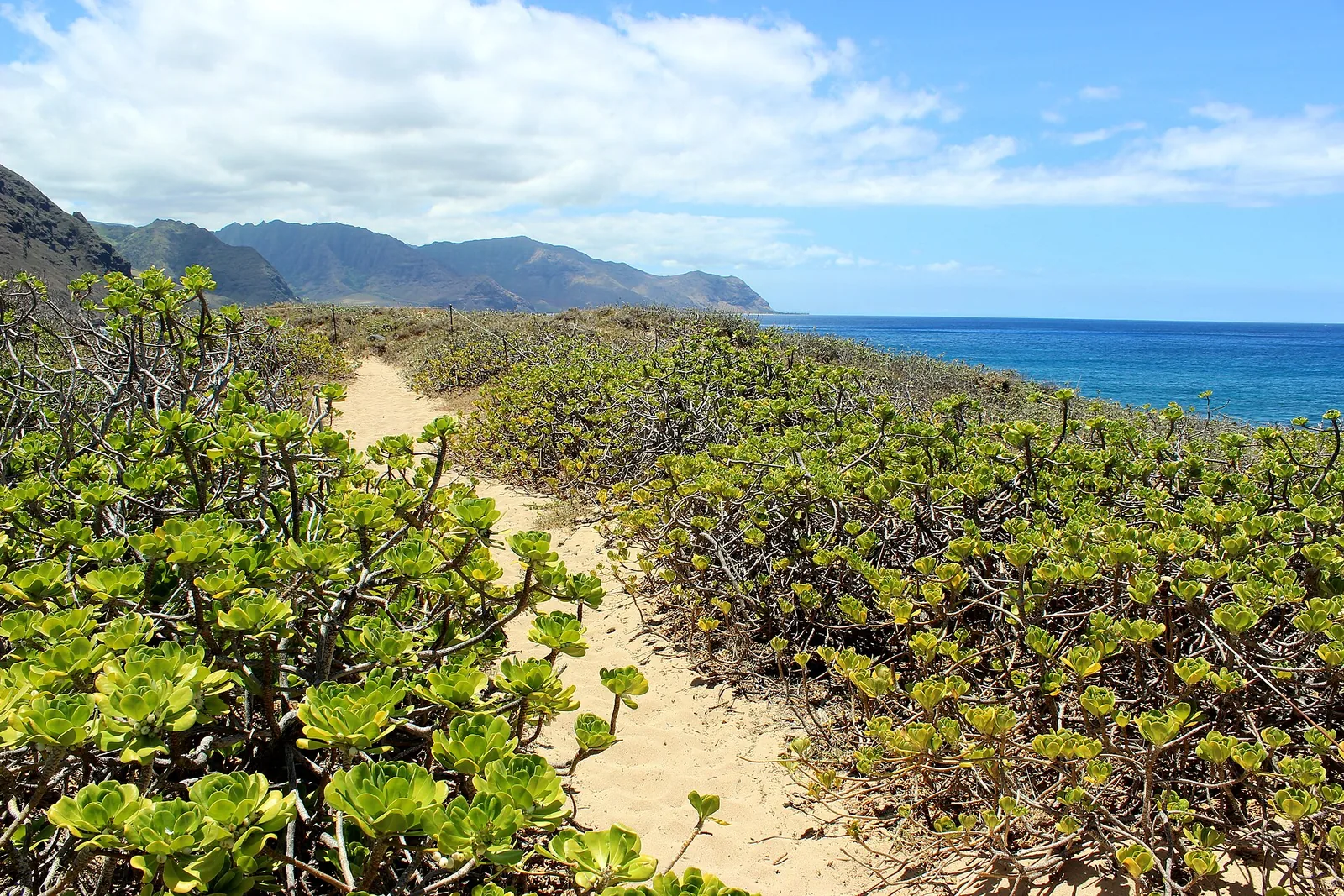
Kaʻena Point is Oʻahu’s far north-west tip, a wild, low headland where the island runs out into the ocean. It is also a place of great spiritual importance in Hawaiian tradition, known as a leaping place of souls. The trail follows an old railway bed along the coast from either end of Farrington Highway. It is flat, 2.5 miles each way, completely unshaded and much hotter than it looks.
At the point, a predator-proof fence protects a natural area reserve where Laysan albatross (mōlī) nest from roughly November to July, alongside wedge-tailed shearwaters. Hawaiian monk seals often rest on the beaches. Stay on the marked path inside the reserve, keep 50 feet from seals and 150 feet from a mother and pup, and never let a dog loose.
After Hurricane Lowell, the Keawaʻula (Waiʻanae) side was closed; the car park has partly reopened, but the trail itself remains shut. Walk in from the Mokulēʻia end only, and check DLNR’s alerts before you set off.
Cost: free · Hours: daylight · Book: no · Bus: not practical · Allow: 1 hour 15 minutes’ drive from Waikīkī to Mokulēʻia, 3 hours on the trail, 3 litres of water per person
Closed, restricted and illegal: hikes to leave off your list
Haʻikū Stairs (Stairway to Heaven). Not a hike. The City and County of Honolulu began removing the stairs in April 2024. Access has always crossed restricted land, and neighbours in Kāneʻohe endured years of trespassers. Anyone who tries now faces police citations and a partly demolished structure on a cliff. For the view, hike Moanalua Valley to the ridge, or choose Kuliʻouʻou or Olomana’s first peak.
Sacred Falls (Kaluanui). Closed since Mother’s Day 1999, when a rockfall killed eight people and injured dozens. It remains closed and illegal to enter. Rockfall risk in the narrow valley has not changed.
Maunawili Falls from the neighbourhood trailhead. Closed since July 2021 because of the impact on residents and the trail. Some older guides still describe it. Do not use it.
Hawaiʻiloa Ridge. The trailhead is inside a gated community, and access is currently limited to residents’ and military guests with a small number of parking permits. Visitors without a permit should hike Kuliʻouʻou instead.
Anything signed kapu, private property or no trespassing. Kapu means forbidden or sacred. Do not enter. Do not look for a way round the sign. And do not share the location of places that local people have deliberately kept off the internet.
Staying safe on Oʻahu trails
The Honolulu Fire Department carries out hiking rescues on Oʻahu week in, week out, many of them by helicopter, and a large share involve people who were simply unprepared: lost after dark, out of water, stuck on a ridge, or injured on mud. A few habits prevent most of them.
Start early. Trailhead parking fills by 8am at weekends. Ridges usually cloud over by late morning, and the heat on exposed trails such as Koko Crater, Diamond Head, Makapuʻu and Kaʻena is serious by 10am.
Know when it gets dark. Sunset is around 6:45pm in late September, close to 6pm in December and around 7:15pm in June, and darkness comes quickly in the tropics. Carry a headlamp even on a short hike, and set a turnaround time.
Carry more water than you think. At least one litre per person for a short hike and two to three litres for a ridge. There is no drinkable water on any trail.
Respect the rain. The windward side and the mountains get far more rain than Waikīkī, and the wet season runs from about October to April. Red clay on ridge trails turns dangerously slick after rain. Streams can flash-flood with almost no warning, even when it is sunny where you are, because the rain is falling upstream. If the water rises, turns brown or starts to roar, get to high ground and wait. Never cross a flooded stream; floods on Oʻahu usually pass within hours.
Stay on the trail. Shortcuts cause erosion and falls. Many rescues start with someone following a side path that looks like the trail.
Tell someone your plan, keep your phone charged, and call 911 early if you are lost or hurt. Do not keep walking in the dark.
Mind leptospirosis. Avoid swimming in or drinking from streams and waterfall pools, especially with cuts or scratches.
Use the boot brushes. Many trailheads have boot-cleaning stations. Scrub your shoes before and after, to slow the spread of invasive weeds and the fungus behind Rapid ʻŌhiʻa Death, which is killing Hawaiʻi’s most important native tree.
What to wear: shoes with deep, grippy soles (trainers with smooth soles are the most common cause of falls on mud), a hat, mineral sunscreen, and a light rain jacket for any ridge.
Trail manners and Hawaiian places
Every trail on Oʻahu crosses land with a Hawaiian name, a history and, often, people who live right next to it. A little care goes a long way, and it is the difference between trails that stay open and trails that close.
Trailheads are in neighbourhoods. Many of the best hikes start at the end of quiet residential streets. Park legally, never across driveways, and keep voices and car doors down before 8am. Maunawili Falls and the Haʻikū Stairs both closed in part because residents had had enough.
Leave the rocks where they are. Do not stack stones into cairns, move rocks at heiau or take lava rock, sand or plants home. Heiau such as Keaīwa are sacred places, not photo props.
Pack everything out. That includes fruit peel and tissues. There are no bins on the trails.
Share the forest. Hunters use many forest reserves, especially at weekends and on holidays, often with dogs. Stay on the trail, wear a bright colour, and let dogs pass. Drones are restricted in state parks and near military areas; assume you cannot fly one without checking the rules.
Learn the names. Lēʻahi rather than only Diamond Head, Kaʻiwa rather than only “the Pillbox”. Using Hawaiian place names is a small, practical way of acknowledging whose land you are walking on, and the concepts of mālama ʻāina (caring for the land) and kuleana (responsibility) are the right frame for any hike here.
Which hike should you choose?
First-time visitors with one morning: Diamond Head, booked for the first slot of the day, then breakfast in Kapahulu. It is the island’s signature view and takes half a day at most.
Families with young children: Makapuʻu Lighthouse in the early morning, or the lower Moanalua Valley. Both are gentle, with no exposure. Mānoa Falls works for children who do not mind mud.
Sunrise: the Lanikai Pillbox, where the sun comes up behind the Mokulua islets. Leave Waikīkī around an hour before sunrise and park at Kailua Beach Park.
A proper workout: the Koko Crater stairs, or Kuliʻouʻou Ridge for a longer day. Both are free and need no booking.
A rainy week: the ʻAiea Loop, which is lower and more sheltered than the summit ridges, or Makapuʻu, which is paved. Avoid Olomana, Kahana Valley and any stream crossing.
No car: Diamond Head, Mānoa Falls and Puʻu Pia from Waikīkī by bus, or the Lanikai Pillbox via Route 67.
Whale season: Makapuʻu Point between January and March, with binoculars, between 7am and 10am.
Photographers: Kuliʻouʻou Ridge on a clear morning after a dry night, when the windward coast is sharp and the clouds have not yet built on the crest.
Guided hikes
You do not need a guide for most of the trails in this guide, but a good one adds real value on longer routes: transport, local knowledge of plants and history, and someone who knows when to turn round. Commercial guided hikes from Waikīkī usually include hotel pickup, water and snacks; compare group sizes and exactly which trail is included before booking, because “rainforest hike” can mean anything from Mānoa Falls to a private ranch. The Hawaiian Trail and Mountain Club and the Sierra Club’s Oʻahu group run public group hikes led by experienced local volunteers, which are an excellent way to meet island hikers and reach trails you would not find alone.
Planning your hikes
If you have a single morning, hike Diamond Head at opening time, or Koko Crater if you want a workout. With a car and a free day, do Kuliʻouʻou Ridge early, then drive round to Makapuʻu for the lighthouse walk and a late lunch. On a North Shore day, combine ʻEhukai Pillbox with a beach afternoon in summer, or with watching the surf in winter.
If you are based in Waikīkī, Diamond Head, Mānoa Falls, Puʻu Pia and the Lanikai Pillbox all work on TheBus; if hiking is the centre of the trip, our where to stay on Oʻahu guide compares bases closer to the windward trails. A single fare is $3.25, and a HOLO card caps your spending at $7.50 a day. Our getting around Oʻahu guide explains the routes, and our Oʻahu itinerary shows how to fit a hike into each day without cramming.
Weather matters more than the month, but the drier months from April to October give the most reliable ridge conditions. See our guide to the best time to visit Hawaiʻi for monthly rain and temperature. When you are done with the mountains, our best beaches on Oʻahu and snorkelling guide cover the other half of the island’s outdoor life, and our things to do on Oʻahu guide brings it all together.
Hiking on the North Shore pairs well with a beach afternoon. Our North Shore Oahu guide covers Haleʻiwa, the surf beaches and the summer snorkel spots in driving order.
Frequently Asked Questions
What are the best hikes on Oahu for beginners?
Makapuʻu Point Lighthouse Trail is the easiest scenic hike: two paved miles with whale-watching views in winter. Diamond Head is short but has steep stairs, and non-residents need a reservation. Mānoa Falls is an easy rainforest walk, though muddy. Puʻu Pia and the valley floor of Moanalua are quiet, gentle options. Start early to avoid heat and crowds, and carry water on all of them.
Do I need a reservation to hike on Oahu?
Only a few trails need one. Diamond Head requires non-residents to reserve an entry time up to 30 days ahead, at $5 per person plus $10 per vehicle. Wiliwilinui Ridge requires signing in at a community security gate. Most other trails, including Koko Crater, Mānoa Falls, Kuliʻouʻou Ridge and Makapuʻu, need no reservation. Always check DLNR closure alerts before you go.
Can you still hike the Haiku Stairs?
No. The Haʻikū Stairs are closed and illegal to access, and the City and County of Honolulu began demolishing them in April 2024. Trespassers face citations and a dangerous, partly removed structure. For similar views of the Koʻolau and windward coast, hike Moanalua Valley to the summit ridge, Kuliʻouʻou Ridge, or the first peak of Olomana in dry weather.
What is the hardest legal hike on Oahu?
Olomana’s second and third peaks are widely considered the most dangerous legal hike on the island, with a razor-thin ridge, crumbling rock and sheer drops. People, including experienced hikers, have died there. Most visitors should stop at the first peak. For a hard but less exposed challenge, Kuliʻouʻou and Wiliwilinui ridges each involve about 1,600 feet of climbing over nearly five miles.
When is the best time of day to hike on Oahu?
Early morning. Start by 7am if you can. Trailhead parking fills quickly, exposed trails get very hot by mid-morning, and clouds usually settle on the Koʻolau ridges by late morning, hiding the view. Sunrise hikes at Lanikai Pillbox and Koko Crater are popular. Whatever you choose, be off the trail well before sunset, which is around 6pm in winter.
Is it safe to swim at waterfalls on Oahu hikes?
Often not. Swimming at Mānoa Falls is prohibited because of rockfall. Freshwater streams and pools can carry leptospirosis, a bacterial infection that enters through cuts, eyes and mouth. Flash floods can turn a calm pool dangerous within minutes after rain upstream. At Waimea Valley, swimming is allowed only when lifeguards permit it, with a life jacket.
Photo Credits
- Map of Oʻahu trailheads: honolulutourism.org, coastline data © OpenStreetMap contributors (ODbL)
- Diamond Head summit trail: Steven Pavlov, CC BY-SA 4.0
- Makapuʻu Point Lighthouse: Pete Markham, CC BY-SA 2.0
- Mānoa Falls: Danieljaycho, CC BY-SA 3.0
- Lanikai Pillbox trail view: Raita Futo from Tokyo, Japan, CC BY 2.0
- Kuliʻouʻou Ridge summit view: Julianibarra, CC0
- Oʻahu ʻelepaio on the ʻAiea Loop: Alan Schmierer, CC0
- Olomana: Travis.Thurston, CC BY-SA 3.0
- Moanalua Valley trail: Gage Skidmore, CC BY-SA 2.0
- Kaʻena Point trail: Aaron Zhu, CC BY-SA 3.0
- Koʻolau ridges above Kāneʻohe (featured image): Daniel Ramirez from Honolulu, USA, CC BY 2.0