Kauaʻi marked 34 years since Hurricane ʻIniki on 11 September 2026, three days after Hurricane Lowell tore through the island’s north and west. Power lines were down, Kōkeʻe’s roads were buried in trees, and every state park on the island was closed. So before any list of things to do in kauai, the most useful thing we can tell you is the date on which this guide was checked, and what was open that day. Kauaʻi has recovered from worse. Its cliffs, canyons and beaches are not going anywhere. But for the next few weeks, the island needs patience from visitors, and some of its best-known experiences will not be available.
This guide covers the island region by region, with a permits-and-reservations panel, a rainfall-by-region table that explains why your forecast may be wrong, an honest three-way comparison of seeing the Nāpali Coast by boat, helicopter and on foot, and the safety information that matters on an island with fewer lifeguards and stronger currents than most. If you are still choosing between islands, start with our guide to which Hawaiian island to visit.
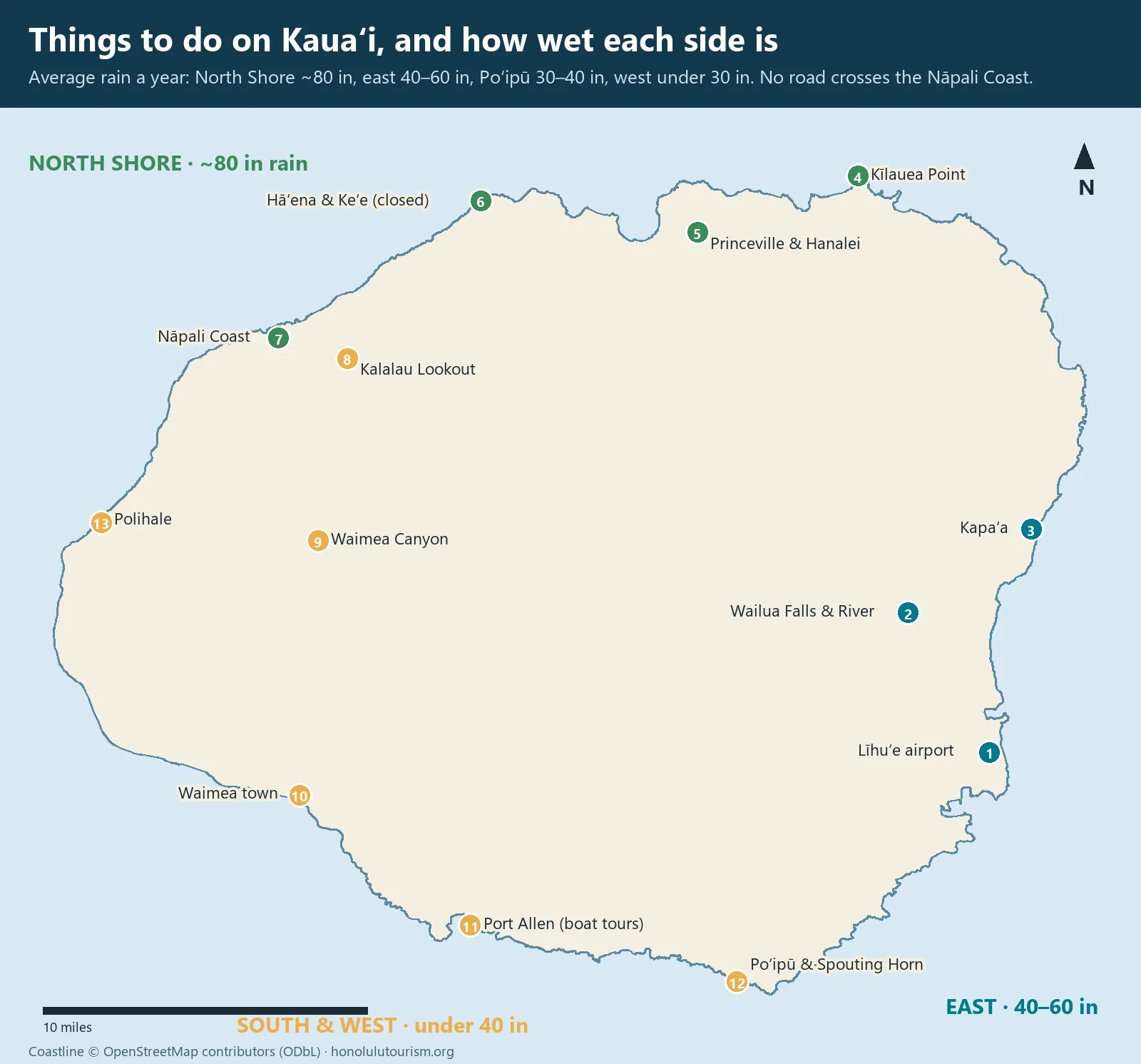
Kauaʻi after Hurricane Lowell: status on 16 September 2026
Conditions are changing daily. Check the County of Kauaʻi, Hawaiʻi Department of Land and Natural Resources and Hawaiʻi Tourism Authority updates before you travel, and again before each outing.
- State parks: all Kauaʻi state parks were closed until further notice, including Kōkeʻe and Waimea Canyon state parks and Hāʻena State Park. Keʻe Beach and the Kalalau Trail were unavailable. DLNR’s update of 13 October 2026: Hāʻena State Park reopens on 15 October; Wailua River State Park partly reopened on 21 September (river and landing access only, no individual kayakers to Fern Grotto, Secret Falls still closed); Kōkeʻe Road, all Kauaʻi camping and the other Kauaʻi state parks remain closed.
- County parks: county beach parks, campgrounds and the Wailua Golf Course were closed until further notice, including Hāʻena Beach Park.
- Roads: the roads to Kōkeʻe and Waimea Canyon were still being cleared. Kūhiō Highway (Routes 56 and 560) was open through to Hāʻena, with crews still removing debris beneath the mauka Wailua River bridge. Halewili Road was open from the ʻEleʻele side but closed from Kalāheo to Kauai Coffee because of downed utility poles.
- Power: restored to more than 80 per cent of affected areas by mid-September, with work continuing.
- Official advice: the Hawaiʻi Tourism Authority encouraged travellers with near-term Kauaʻi plans to reschedule or choose another island, rather than cancel their Hawaiʻi trip.
What that means for you. If your trip is in the next two to three weeks, contact your accommodation and tour operators, and seriously consider moving your dates or switching islands; our guides to Maui and the Big Island may help. If your trip is later in the autumn or winter, keep your booking, watch the updates, and expect most of the island to be open. When you do come, remember that residents are cleaning up their own homes. Drive patiently, follow closures, and spend with local businesses.
Permits and reservations: the Kauaʻi control panel
Kauaʻi manages visitor numbers at its most popular natural sites more tightly than any other island. These are the systems to know. All were affected by the post-Lowell closures in September 2026, so confirm each one is operating before you plan around it.
| Site | What you need | Cost (non-residents) | Booking window | Status, 16 Sep 2026 |
|---|---|---|---|---|
| Hāʻena State Park (Keʻe Beach, Kalalau trailhead) | Entry or parking reservation, or North Shore shuttle ticket | $5 per person entry, or $10 parking per vehicle; shuttle $40 (16+), $25 (ages 4–15) | gohaena.com, 30 days ahead, released at 12am HST | Closed |
| Kalalau Trail beyond Hanakāpīʻai, and camping | Nāpali Coast State Wilderness Park camping permit | $35 per person per night | DLNR camping reservations; limited daily numbers | Closed |
| Kōkeʻe and Waimea Canyon state parks | State park entry and parking fees | Non-resident fees apply | Pay on site or online | Closed; roads being cleared |
| Kīlauea Point National Wildlife Refuge | Timed-entry reservation | Entrance fee | recreation.gov | Check before visiting |
| Nāpali Coast boat tours | Tour booking | $130–280, 4–7 hours | Online; weeks ahead in summer | Check with operators |
| Helicopter tours | Tour booking | $280–450, 50–90 minutes | Online; a week or more ahead | Check with operators |
How Hāʻena reservations work, in normal times. Hāʻena State Park, at the end of the road on the north shore, limits daily visitors to protect the area and the community of Hāʻena. Non-residents must book either a parking reservation or park entry with the North Shore shuttle on gohaena.com. Reservations open 30 days ahead at midnight Hawaiʻi time and parking often sells out quickly. Overnight Kalalau campers have separate permits and may not park at Hāʻena. Rules have changed several times since the reservation system began in 2019, so read the current details on the official site.
Things to do in Kauai: rainfall by region
Kauaʻi’s weather confuses visitors because it varies so sharply over a few miles. Mount Waiʻaleʻale, near the centre of the island, receives around 450 to 500 inches of rain a year, making it one of the wettest spots on Earth. Trade winds push rain onto the north and east; the south and west sit in a rain shadow. A forecast of “rain on Kauaʻi” usually means rain somewhere, not everywhere.
| Region | Towns and sights | Average rain a year | What that means |
|---|---|---|---|
| Centre | Mount Waiʻaleʻale | About 450–500 inches | Source of the island’s rivers and waterfalls |
| North Shore | Princeville, Hanalei, Kīlauea, Hāʻena | About 80–85 inches (Hanalei about 78) | Green and lush; winter rain and flooding can close the road |
| East (Coconut Coast) | Līhuʻe, Wailua, Kapaʻa, Anahola | About 40–60 inches | Passing showers, usually brief |
| South | Poʻipū, Kōloa | About 30–40 inches | The sunniest resort area |
| West | Waimea, Kekaha, Polihale | Under about 30 inches | Dry, hot and sunny; the rain shadow |
The practical rule: if it is pouring in Hanalei, drive south. If it is raining everywhere, it is probably a big weather system, and the day is better spent indoors than on a trail or river.
The Nāpali Coast: boat, helicopter or on foot?
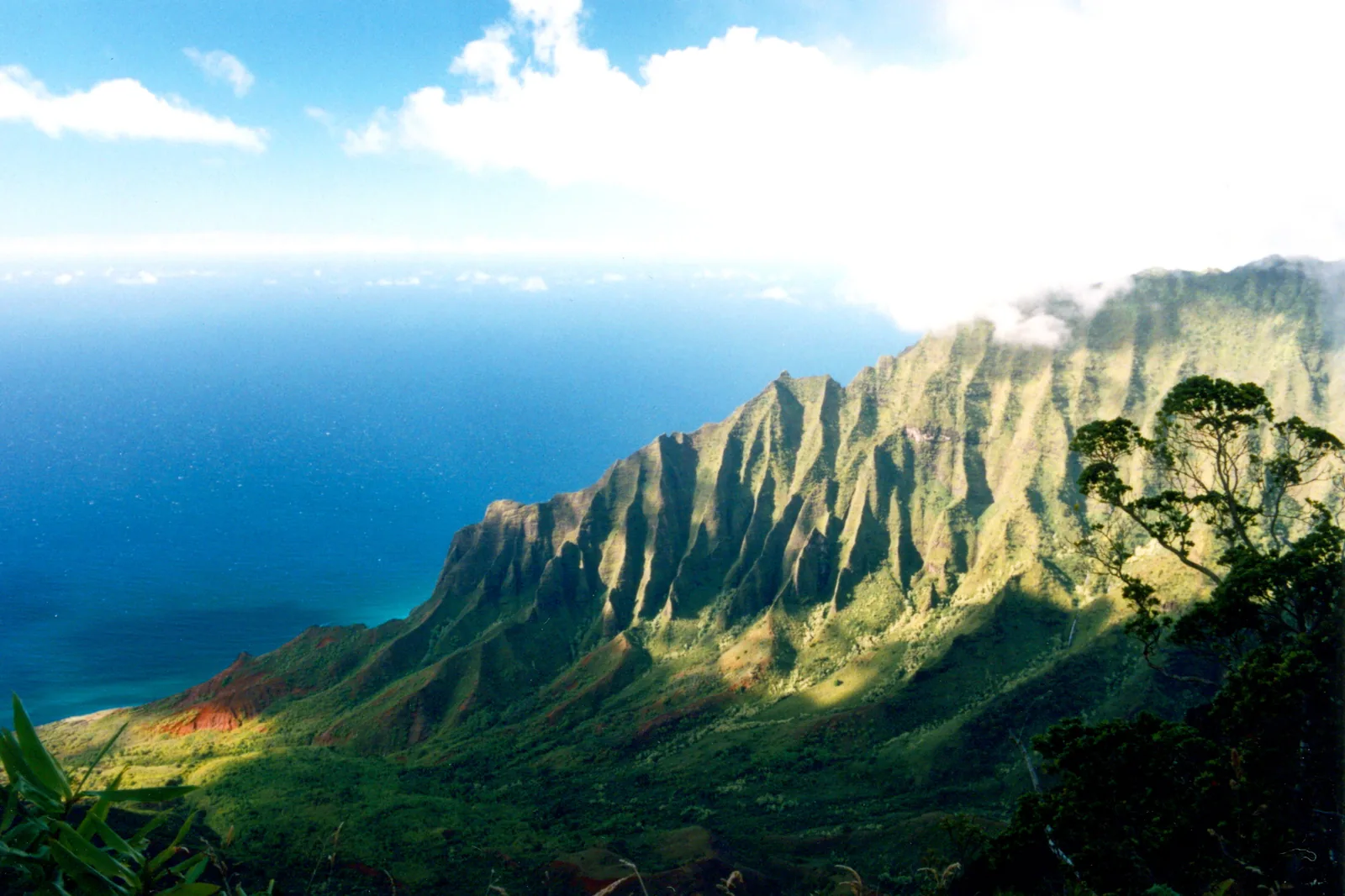
The Nāpali Coast is a 17-mile stretch of the north-west shore where green, fluted cliffs rise thousands of feet from the ocean, cut by hanging valleys, waterfalls and sea caves. No road runs along it. There are three ways to see it, and each has real trade-offs.
| By boat | By helicopter | On foot (Kalalau Trail) | |
|---|---|---|---|
| 2026 price | $130–280 | $280–450 | Hāʻena park reservation; camping $35 per night beyond Hanakāpīʻai |
| Time | 4–7 hours | 50–90 minutes | 4 hours to Hanakāpīʻai Beach and back; 2 days or more to Kalalau |
| What you see | Cliffs, sea caves, dolphins; whales in season; snorkelling on some trips | The whole coast plus Waimea Canyon and Waiʻaleʻale’s crater walls | Cliffside views, valleys and beaches up close |
| Best season | Summer, when seas are calmer | Year-round, clear mornings | Summer; dry weather only |
| Seasickness | Likely for many on rafts; less on catamarans | Rarely, though turbulence happens | None |
| Cancellation risk | High in winter swell | Medium; low cloud and wind | Flooding closes streams and the park |
| Fitness | Low (rafts are rough on backs) | None | Moderate to very high |
| Verdict | Best all-round value in summer | Best if you only do one, and in winter | Best for fit hikers, in dry weather |
By boat
Boat tours leave from Port Allen on the south-west coast year-round, and from Hanalei on the north shore in the calmer months. Large catamarans offer shade, toilets, food and a smoother ride. Rigid-hulled rafts, sometimes called zodiacs, are faster, get closer to the cliffs and into sea caves when conditions allow, but pound hard over swells. They are not suitable for people with back or neck problems, or pregnant travellers. In summer, many tours stop to snorkel; in winter, big north swells often prevent boats from reaching the full coast, and trips are cancelled at short notice. Take seasickness medication before boarding, not after you feel ill.
Cost: $130–280 · Hours: morning departures are calmest · Book: online, weeks ahead in summer · Drive: Port Allen is 30 minutes from Poʻipū, 40 minutes from Līhuʻe · Allow: 4–7 hours
By helicopter
A helicopter is the only way to see the entire Nāpali Coast, the depths of Waimea Canyon and the waterfall-streaked walls of Waiʻaleʻale’s crater in a single hour. Flights from Līhuʻe cost roughly $280–450 for 50 to 90 minutes. Doors-off flights in small four-passenger helicopters give the best photos; Jack Harter’s 60- to 65-minute doors-off tour, for example, costs $399. Morning flights usually have the clearest skies. Weight limits and seat assignments apply. If you will take only one helicopter flight in Hawaiʻi, Kauaʻi is the island to do it on.
Cost: $280–450 · Hours: morning flights clearest · Book: online, a week or more ahead · Drive: Līhuʻe · Allow: 2 hours including check-in
On foot: the Kalalau Trail
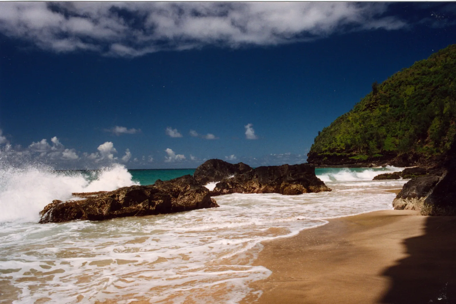
The Kalalau Trail begins at Keʻe Beach in Hāʻena State Park. The first two miles, to Hanakāpīʻai Beach, is a steep, rocky and often muddy day hike with superb coastal views; allow around four hours round trip. Going further, to Hanakāpīʻai Falls or beyond, and to Kalalau Beach at 11 miles, requires fitness, experience and, beyond Hanakāpīʻai, a camping permit.
Two warnings. First, do not swim at Hanakāpīʻai Beach. Its currents have drowned many people, and a hand-painted sign at the trail tallies the deaths. Second, never cross Hanakāpīʻai Stream when it is high or rising: hikers have been swept away and trapped by flash floods. If in doubt, wait, or turn back.
The North Shore
The North Shore is Kauaʻi’s most beautiful and most fragile region: a single narrow road, dozens of one-lane bridges, taro fields, and beaches backed by mountains streaked with waterfalls. It is also the wettest part of the island and the most exposed to winter surf.
Hanalei
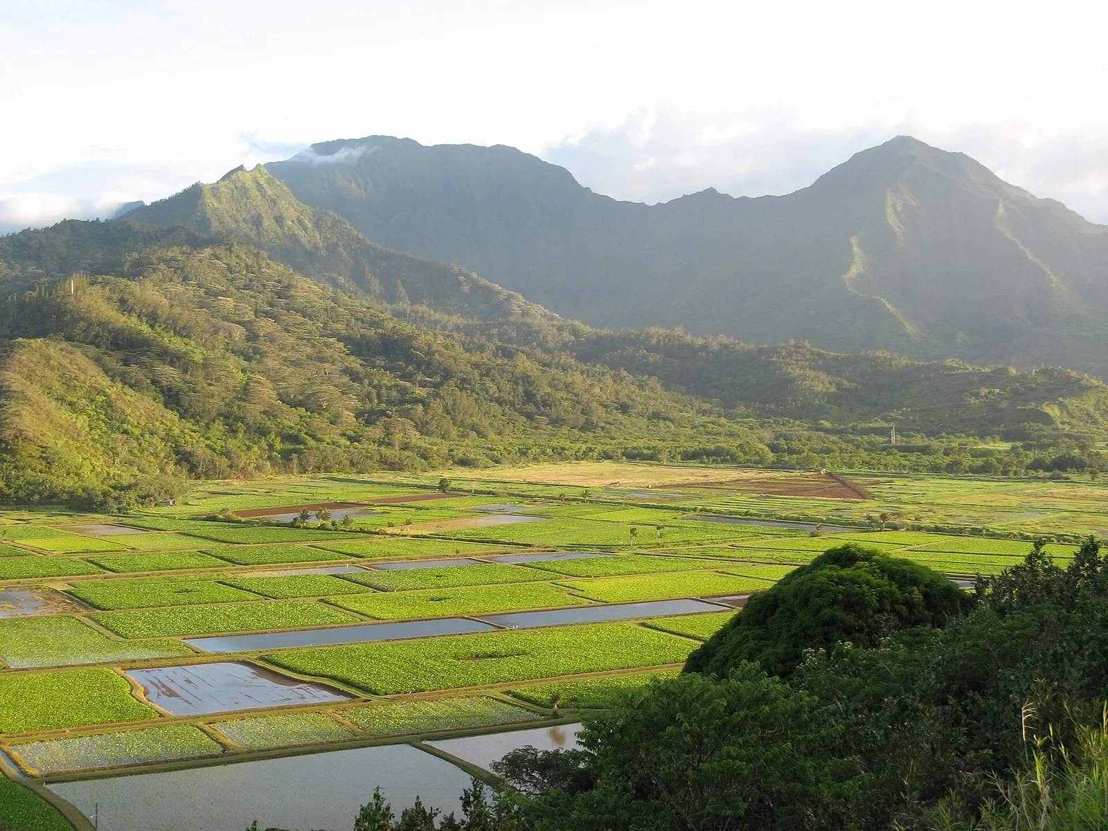
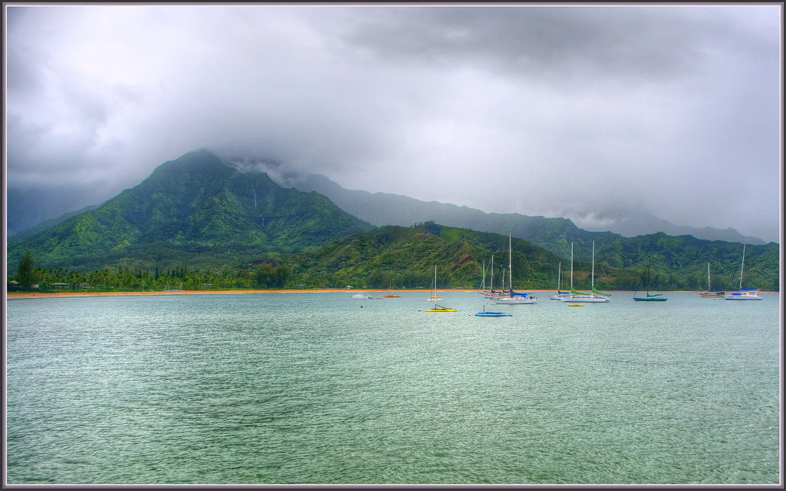
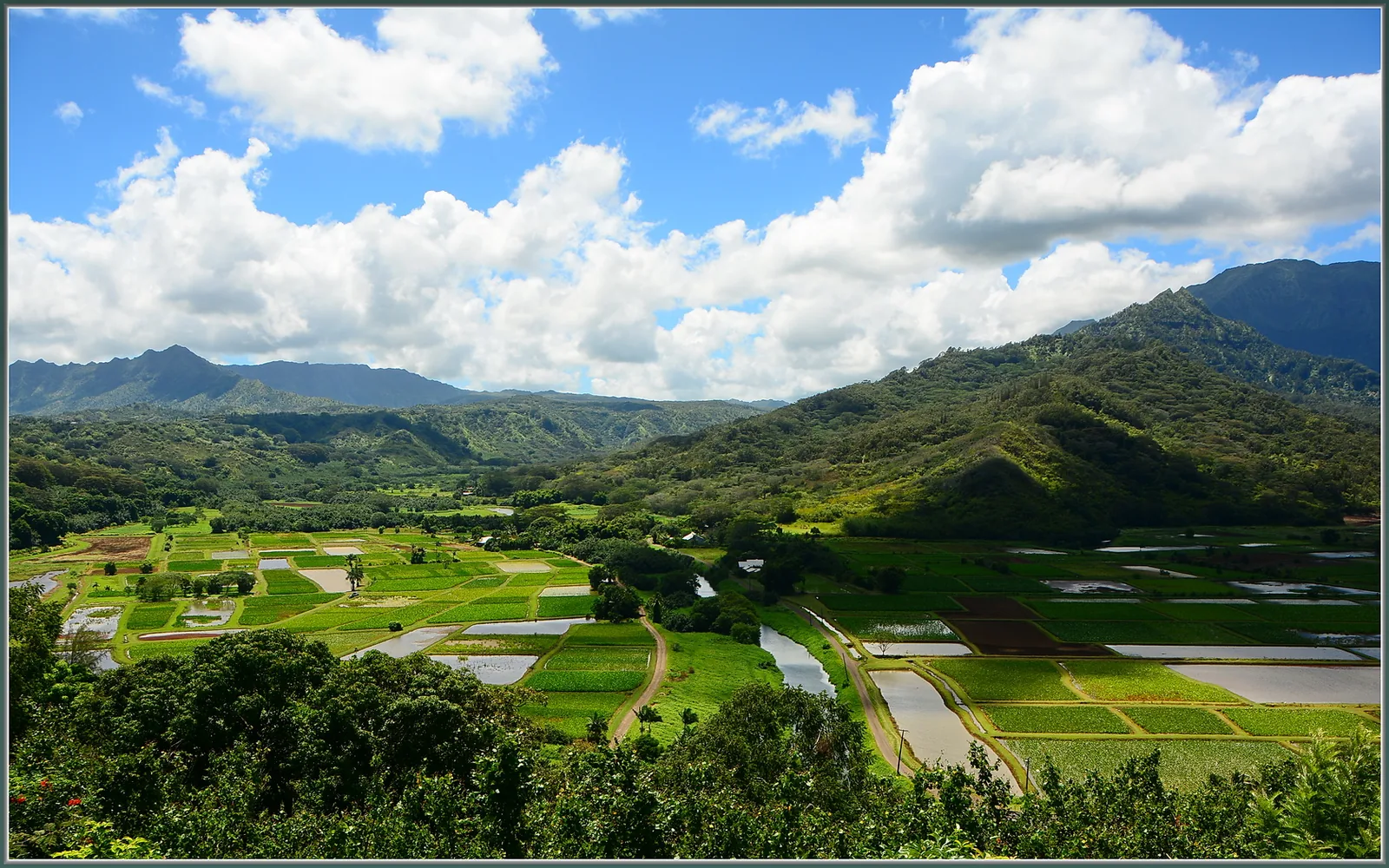
Hanalei Bay is a two-mile crescent of sand beneath green mountains, with a historic pier at one end. In summer, the water is often calm enough for swimming and paddleboarding; in winter, big surf rolls in and swimming can be dangerous. Hanalei town has cafés, surf shops and a relaxed charm. Just before town, the Hanalei Valley lookout looks down on the taro fields of the Hanalei National Wildlife Refuge, one of the largest taro-growing areas in Hawaiʻi, where endangered native waterbirds live among the patches. Stay on the road; the fields are working farms and wildlife habitat.
Kīlauea Point and ʻAnini
Kīlauea Point National Wildlife Refuge protects a lighthouse on a dramatic headland and nesting colonies of seabirds, including red-footed boobies, Laysan albatross and wedge-tailed shearwaters. Nēnē and, in winter, humpback whales can often be seen. Entry is by timed reservation on recreation.gov with an entrance fee. Nearby ʻAnini Beach, protected by one of the longest fringing reefs in Hawaiʻi, is one of the calmest swimming and snorkelling spots on the North Shore in most conditions.
Tunnels, Keʻe and Hāʻena
At the end of the road, Makua (Tunnels) Beach has spectacular snorkelling over a wide reef in calm summer conditions. Keʻe Beach, inside Hāʻena State Park, has a small lagoon protected by the reef in summer. In winter, both can be extremely dangerous. Limahuli Garden and Preserve, run by the National Tropical Botanical Garden, protects a valley of native plants and ancient Hawaiian terraces.
Do not visit Queen’s Bath in Princeville. This lava-rock pool has killed many visitors swept off the ledge by waves, even on days that look calm.
The East Side: Wailua and Kapaʻa
The Coconut Coast, between Līhuʻe and Anahola, is Kauaʻi’s most populated area, with Kapaʻa’s shops and restaurants, mid-priced hotels, and easy access to both north and south.
Wailua River and Wailua Falls
The Wailua River is Hawaiʻi’s only navigable river, and its valley was once the royal and religious centre of Kauaʻi. Along its banks, Wailua River State Park protects a complex of sacred sites, including Holoholokū, a heiau and royal birthing place. Treat them with respect; do not climb on stones or leave offerings. Kayak tours paddle upriver and hike to a waterfall. Rentals and tours are controlled by permitted operators.
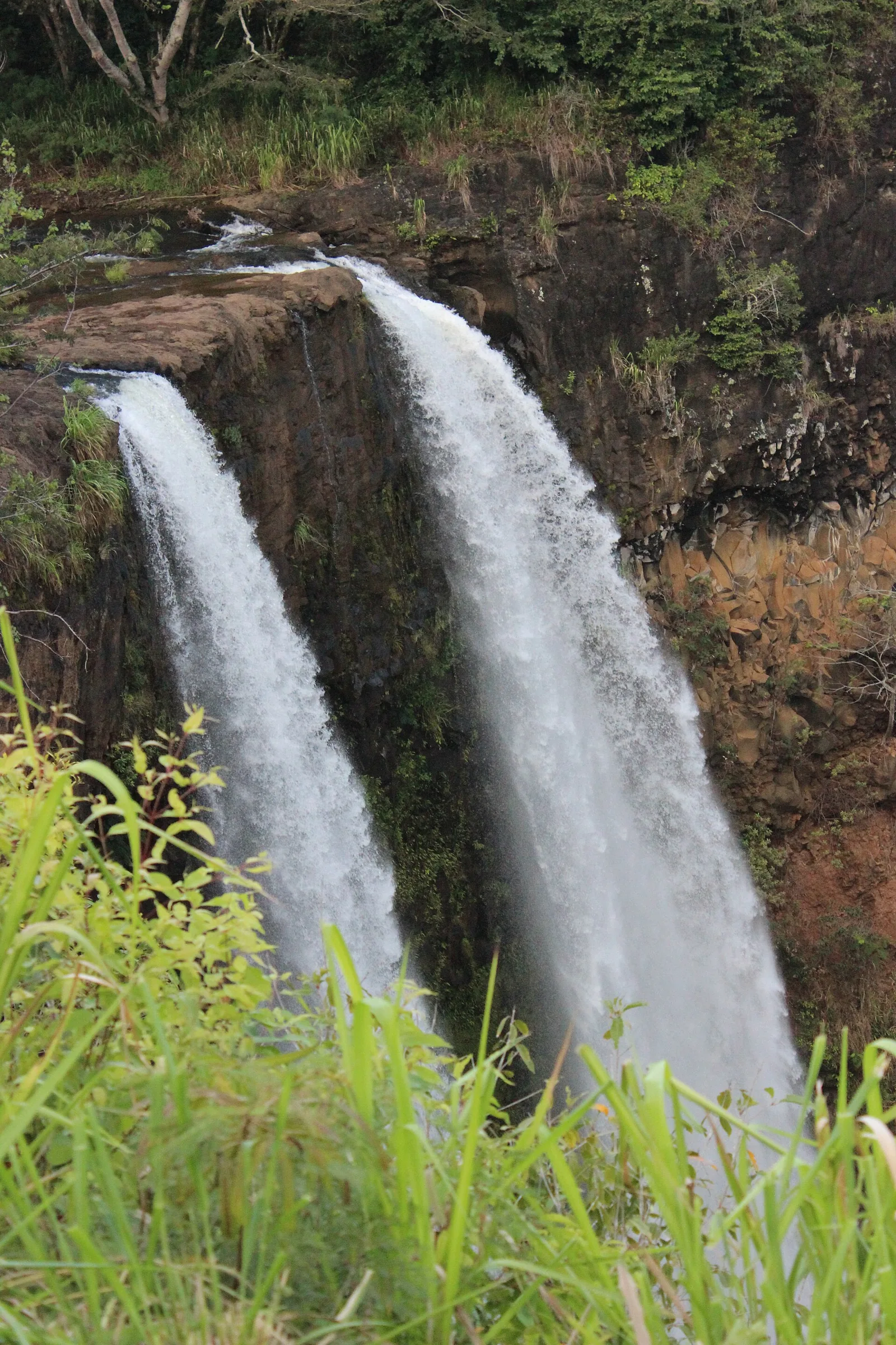
Wailua Falls, a double waterfall, is visible from a roadside lookout at the end of Maʻalo Road above Līhuʻe. Do not climb down to the base: the path is unofficial, slippery and has caused serious injuries and deaths. ʻŌpaekaʻa Falls, on the road inland from Wailua, is another easy roadside lookout.
Sleeping Giant and the coastal path
The Nounou Mountain trails, known as Sleeping Giant, climb a ridge above Wailua that looks, from below, like a reclining figure. The East Trail is a steep, moderate hike of a few miles with views over the coast; go early to avoid heat. Ke Ala Hele Makalae, a paved coastal path north of Kapaʻa, is ideal for walking or cycling, with whale-watching views in winter.
The South Shore: Poʻipū and Kōloa
Poʻipū is Kauaʻi’s sunniest resort area, with calm beaches, good snorkelling, and a wide range of condos and hotels. It is the best base for families and for anyone who wants reliable sunshine.
Poʻipū Beach Park
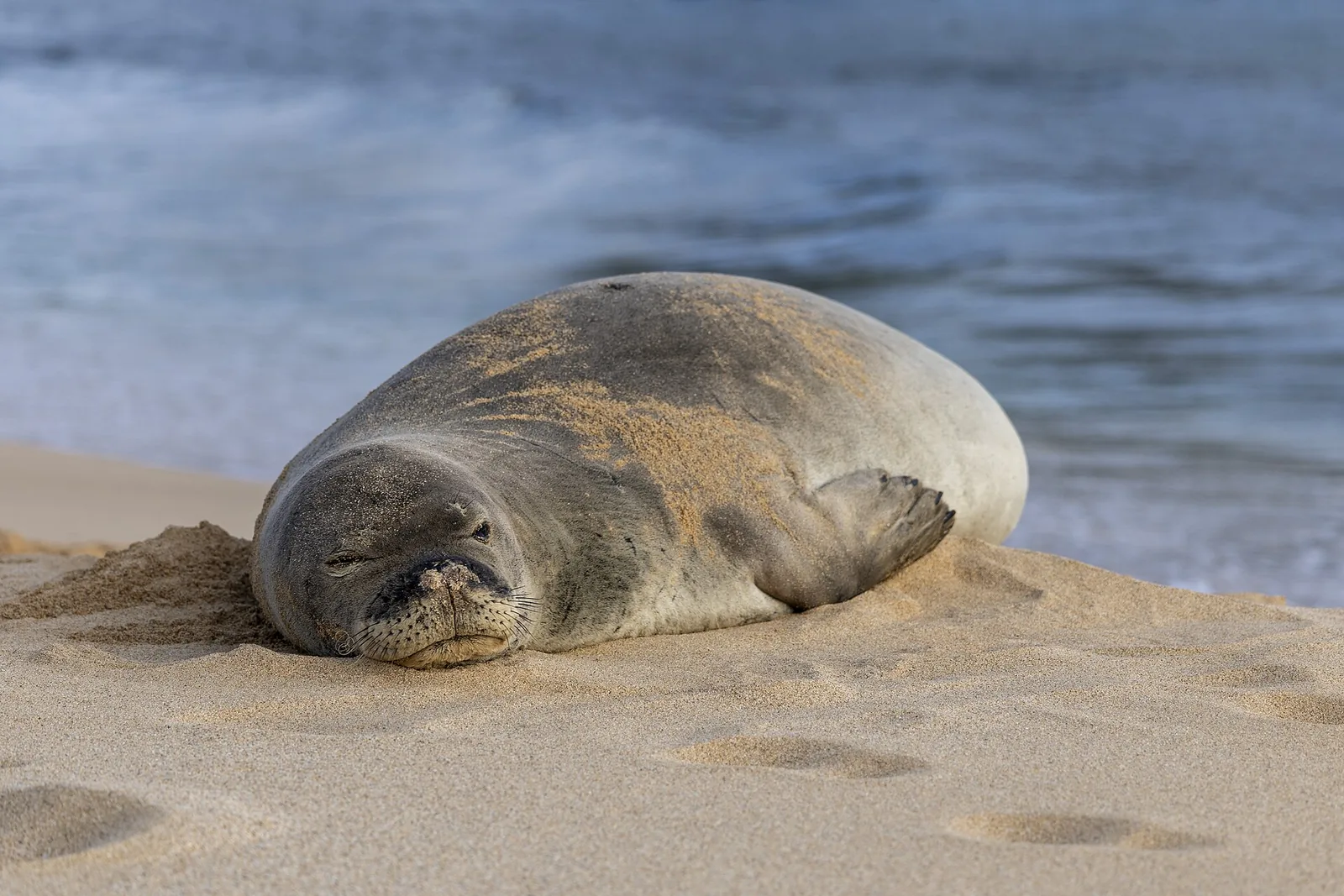
A sandbar, or tombolo, creates a shallow, protected swimming area at Poʻipū Beach Park, with lifeguards, facilities and gentle snorkelling. Green sea turtles and, often, endangered Hawaiian monk seals rest on the beach. Volunteers often rope off a resting seal; stay at least 50 feet away (150 feet from a mother and pup), keep dogs away, and never feed or touch wildlife.
Spouting Horn, Kōloa and the gardens
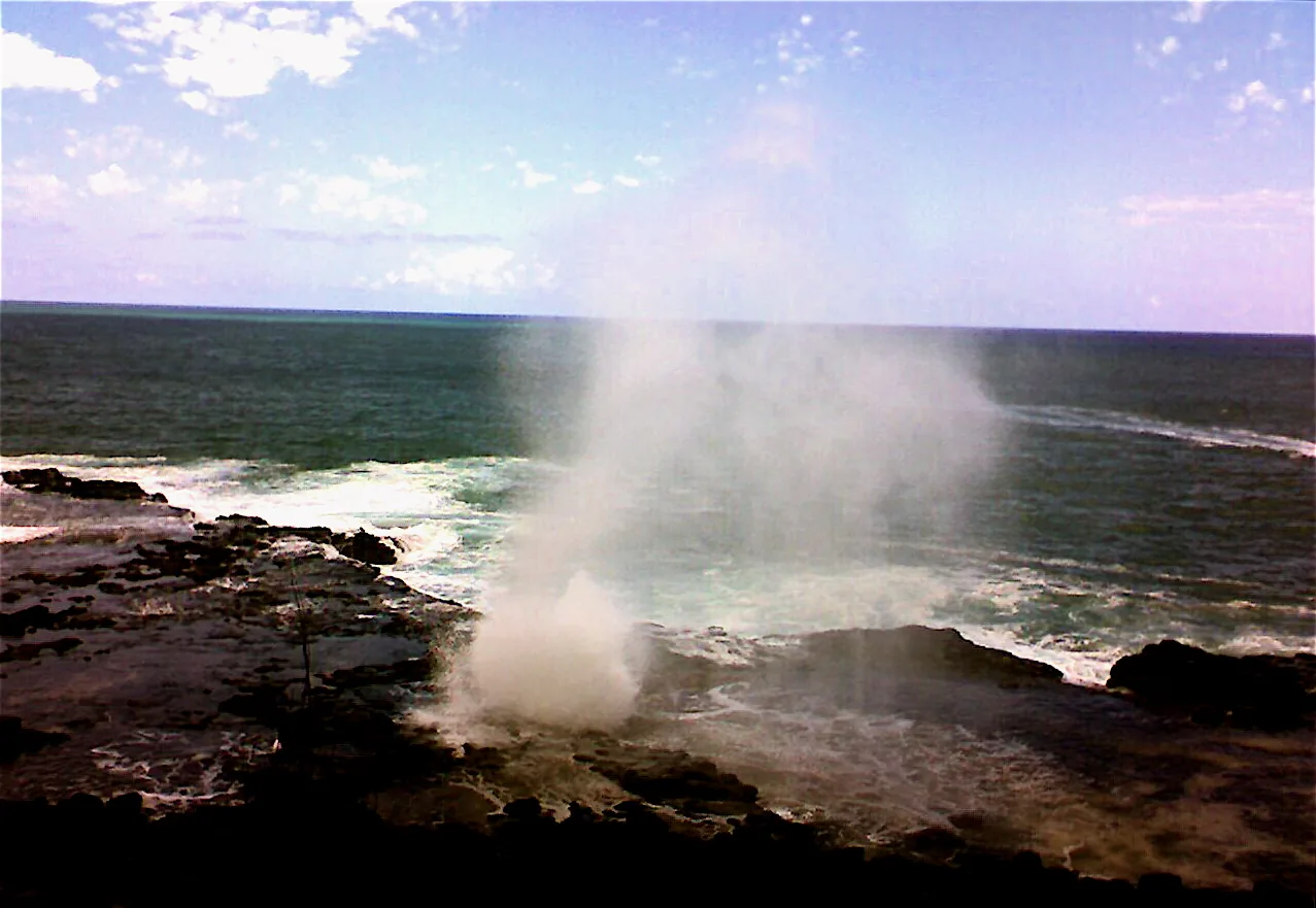
Spouting Horn, just west of Poʻipū, is a lava tube where waves force water and air through a hole in the rock, sending spray high into the air with a moaning sound. It is free and best seen from the viewing area; do not climb onto the rocks. Old Kōloa Town, where Hawaiʻi’s first commercial sugar plantation began in 1835, has shops and restaurants in historic buildings. The Tree Tunnel of eucalyptus along Maluhia Road is the classic entrance to the South Shore.
The National Tropical Botanical Garden’s McBryde and Allerton gardens, in the Lāwaʻi Valley, are two of the finest tropical gardens in Hawaiʻi, visitable on paid tours.
Cost: Poʻipū Beach Park and Spouting Horn free; gardens charge for tours · Hours: daylight · Book: garden tours ahead · Drive: 25 minutes from Līhuʻe · Allow: a full day in the area
The West Side: Waimea Canyon, Kōkeʻe and Waimea
Waimea Canyon
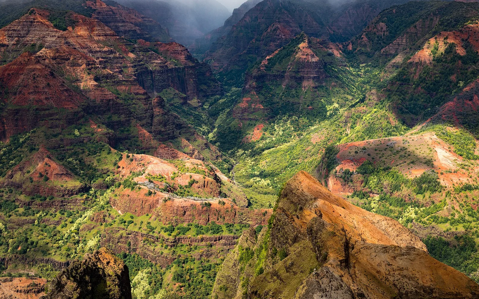
Waimea Canyon, about 14 miles long and up to about 3,600 feet deep, is often called the Grand Canyon of the Pacific. Its red, rust and green walls, carved by rivers and the collapse of the volcano that built Kauaʻi, are best seen from the lookouts along Waimea Canyon Drive and Kōkeʻe Road. Go early, before clouds build. Short hikes such as the Canyon Trail lead to Waipoʻo Falls; longer ones need preparation. As of mid-September 2026, the park and its roads were closed after Hurricane Lowell.
Kōkeʻe and the Kalalau Lookout
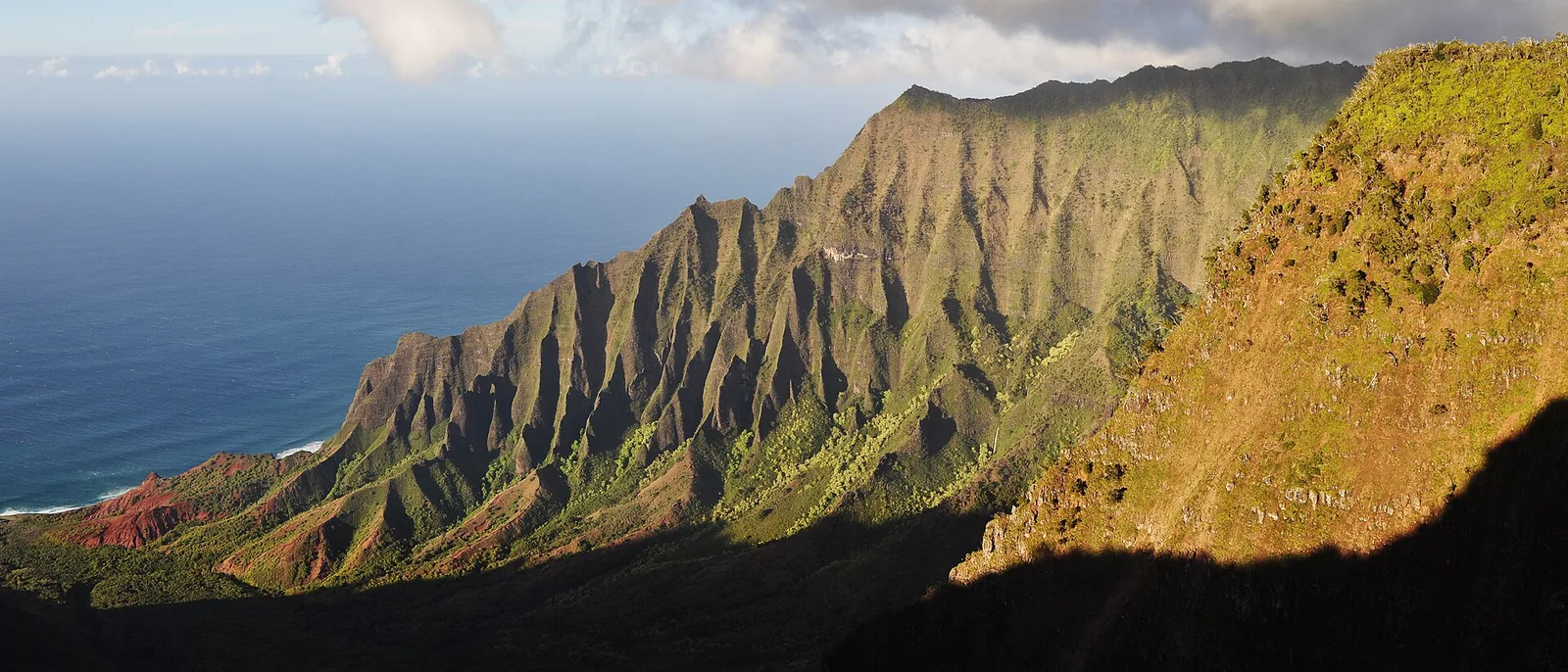
Above the canyon, at around 4,000 feet, Kōkeʻe State Park is a cool upland forest with a small museum, hiking trails and, at the end of the road, the Kalalau and Puʻu O Kila lookouts over the Nāpali Coast’s Kalalau Valley. On a clear morning, it is one of the greatest views in Hawaiʻi; by midday, it is often lost in cloud. Trails such as Awaʻawapuhi drop along narrow ridges above the coast and are strenuous and exposed.
Waimea town, Hanapēpē and Polihale
Waimea is where Captain James Cook first landed in Hawaiʻi in 1778, a moment that changed the islands for ever. The town has a relaxed, local feel, a Hawaiian fishpond heritage and the ruins of a nineteenth-century Russian fort. Hanapēpē, “Kauaʻi’s biggest little town”, has galleries and a weekly Friday evening art night. Nearby, Salt Pond Beach Park is next to traditional salt beds still worked by local families; do not enter the salt pans. At the island’s western end, Polihale is a vast, remote beach reached by a rough dirt road. It is spectacular at sunset and dangerous for swimming, and access has been restricted at times; check before going.
Hiking on Kauaʻi
Kauaʻi has the most varied hiking of any Hawaiian island, from coastal walks to ridge routes above the Nāpali cliffs. After Hurricane Lowell, state park and forest reserve trails were closed in September 2026, and fallen trees and landslides may keep some closed for longer. Check DLNR’s Nā Ala Hele trail pages before setting out.
Māhāʻulepū Heritage Trail. A coastal walk of about two miles each way from Shipwreck Beach in Poʻipū, past lithified sand dunes, sea cliffs, blowholes and Makauwahi Cave, an important fossil and archaeological site. It is exposed and windy, and the cliff edges are unstable. Stay back from the edge.
Kuilau Ridge Trail. A moderate forest walk inland from Wailua, with views of Waiʻaleʻale’s slopes when clouds allow, and picnic shelters along the way. It is muddy after rain.
Sleeping Giant (Nounou). Three routes lead up the ridge above Wailua. The East Trail is the most popular. The final scramble to the “chin” is exposed; many hikers stop at the picnic shelter below it.
Kōkeʻe trails. The Canyon Trail leads to Waipoʻo Falls and views down Waimea Canyon. Pihea and Alakaʻi Swamp trails cross boardwalks through native bog and forest to lookouts over the north shore on clear days. Awaʻawapuhi and Nualolo follow narrow ridges down towards the Nāpali Coast; they are strenuous and exposed, with a long climb back up.
Kalalau Trail. Covered above: the first two miles to Hanakāpīʻai Beach are a day hike with a Hāʻena reservation; beyond that you need a camping permit and serious experience.
On any Kauaʻi hike: start early, carry a rain layer and plenty of water, never cross rising streams, turn back if the red clay is slick, and be off the trail before dark. Leptospirosis is present in freshwater streams; avoid swimming with cuts.
Things to do in Kauai with children or on a rainy day
Kauaʻi suits families who enjoy the outdoors and do not need theme parks. The best base is Poʻipū, for its calm, lifeguarded beach and sunny weather. Poʻipū Beach Park’s shallow, reef-protected swimming area is ideal for young children, and turtles and monk seals provide wildlife viewing without getting in the water. Lydgate Beach Park in Wailua has rock-walled pools that are usually calm, and a large wooden playground; like other county parks, it was closed after Lowell, so check before going.
Older children enjoy a Wailua River kayak trip to a waterfall, a Nāpali catamaran tour with snorkelling in summer, and the Kīlauea Point seabird colonies. Waimea Canyon’s lookouts are an easy win in the car. Save rafts, long ridge hikes and helicopter flights for teenagers comfortable with motion and heights, and check helicopter operators’ age and weight policies.
On rainy days, remember the rule: drive to the dry side. If it is raining on the North Shore, Poʻipū or Waimea may well be sunny. If rain is island-wide, visit the Kauaʻi Museum in Līhuʻe for the island’s history, browse Old Kōloa Town and Hanapēpē’s galleries, or take a garden tour, where rain is part of the experience. Avoid rivers, waterfalls and stream crossings in heavy rain, and stay out of the ocean near stream mouths for 72 hours afterwards.
A short history of the Garden Island
Kauaʻi is the oldest of the main Hawaiian Islands, formed around five million years ago, which is why its mountains are so deeply eroded into canyons, valleys and cliffs. Polynesian voyagers settled it more than a thousand years ago. Stories of the Menehune, a legendary people of skilled builders, are attached to old stonework such as the Alekoko (Menehune) Fishpond near Līhuʻe.
Kauaʻi holds a special place in Hawaiian history because it was never conquered by Kamehameha I. His invasion fleets were turned back by storms and disease, and in 1810 Kauaʻi’s ruler, Kaumualiʻi, agreed to accept Kamehameha’s rule peacefully, bringing all the islands under one kingdom. Captain James Cook made the first recorded European landing in Hawaiʻi at Waimea in 1778. In the nineteenth century, Kōloa became the site of Hawaiʻi’s first commercial sugar plantation, and immigrants from China, Japan, Portugal, the Philippines and elsewhere came to work the fields, shaping the island’s population and food.
In more recent memory, Hurricane ʻIniki devastated Kauaʻi on 11 September 1992, and the island took years to recover. Its landscapes became famous worldwide through films, including Jurassic Park. Neighbouring Niʻihau, visible from the West Side, is privately owned, home to a small Hawaiian-speaking community, and closed to casual visitors; please respect that.
What Kauaʻi costs
Kauaʻi is one of the more expensive Hawaiian islands. Across the state, visitors spent an average of $296 a person per day in July 2026, and Kauaʻi’s resort areas, car rental and dining tend to sit at the higher end. Lodging taxes, including the Green Fee introduced in 2026, and resort fees add significantly to nightly rates; always compare the all-in price.
Budget for a rental car for the whole stay, at least one paid Nāpali experience ($130–280 by boat, $280–450 by helicopter), Hāʻena reservations (the park reopens on 15 October 2026), and garden or kayak tours. Save money with condos with kitchens, farmers markets, food trucks, and the island’s many free beaches, lookouts and coastal walks.
Kauaʻi’s ocean: read this before you swim
Drowning is the leading cause of injury death for visitors to Hawaiʻi, and Kauaʻi’s beaches are among the most hazardous in the state. The island has fewer lifeguarded beaches than Oʻahu or Maui, much of its coast is exposed to open-ocean swell, and currents are powerful. Snorkelling is involved in close to a third of visitor drownings across Hawaiʻi.
- Swim at lifeguarded beaches, such as Poʻipū Beach Park, Salt Pond, Lydgate, Anini (reef-protected) and Hanalei in calm conditions, and ask the lifeguard about the day’s conditions.
- Assume north- and west-facing beaches are unsafe for swimming from roughly October to April.
- Never swim at Hanakāpīʻai, Lumahaʻi, or Polihale in rough conditions, and never visit Queen’s Bath.
- Stay out of the ocean near stream mouths for 72 hours after heavy rain.
- Keep 10 feet from turtles and 50 feet from monk seals.
- Use reef-safe mineral sunscreen.
Our snorkelling safety guide explains the specific risks of snorkelling, which apply on every island.
More on the water
Wailua River kayaking. The classic guided trip paddles a few miles upriver, then follows a jungle trail to a waterfall. Paddling is gentle, but the trail is muddy and crosses a stream. Trade winds can make the return paddle harder than expected.
Surf lessons. Poʻipū’s gentle south-shore waves are the best place to learn, especially in summer. Hanalei Bay has lessons in the calmer months. Book a morning session before the wind picks up.
Snorkelling. In calm conditions, Poʻipū Beach Park, Lawaʻi Beach and Koloa Landing in the south, ʻAnini in the north, and Tunnels and Keʻe in summer are the best. Koloa Landing is also a popular shore dive. Never snorkel alone, and never at north-facing beaches in winter swell.
Whale watching. From roughly December to March, humpback whales pass along Kauaʻi’s coasts. Nāpali boat tours in winter double as whale watches, and Kīlauea Point, the Kapaʻa coastal path and Poʻipū’s shoreline are good for spotting from land. Vessels must stay 100 yards from humpbacks.
Stand-up paddleboarding. The Hanalei River and the Wailua River are calm places to try it, away from ocean swell.
Responsible travel on Kauaʻi
Kauaʻi’s residents have been clear for years that they value visitors who move slowly, respect limits and care for the island. That matters more than ever this autumn.
- Follow closures. After Lowell, closures protect you and allow crews to work. Do not drive around barriers or hike closed trails.
- Respect the reservation systems. Hāʻena’s limits exist because the community and the environment were overwhelmed by visitor numbers before 2019.
- Stay off private land. Many “secret” waterfalls and beaches shared online cross private or sacred land. Kapu means do not enter.
- Protect wildlife. Keep 10 feet from turtles, 50 feet from monk seals and 100 yards from whales. Never feed wild animals, including the island’s famous feral chickens.
- Protect the reef. Use mineral sunscreen, do not stand on coral and take nothing from the beach.
- Drive with aloha. Pull over to let local traffic pass on the North Shore, and follow one-lane bridge etiquette.
- Spend locally. Farmers markets, food trucks and family-run shops keep money on the island, which matters as businesses recover.
Combining Kauaʻi with other islands
Kauaʻi pairs most naturally with Oʻahu: flights between Līhuʻe and Honolulu take about 35 minutes, and the contrast between Honolulu’s energy and Kauaʻi’s quiet is part of the appeal. For a ten-day trip, spend four nights on Oʻahu and six on Kauaʻi, split between Poʻipū and the North Shore. Kauaʻi and Maui together make a scenery-focused fortnight, though flights often connect through Honolulu. Given the post-Lowell situation, build flexibility into any autumn 2026 itinerary, so that you can shift nights between islands if Kauaʻi’s parks are slow to reopen.
Eating on Kauaʻi
Kauaʻi’s food is small-scale and local: farmers markets, food trucks, poke counters, shave ice and fish tacos, with a handful of excellent sit-down restaurants in Poʻipū, Kapaʻa and Hanalei. Look for taro grown in Hanalei, Kauaʻi coffee from the West Side, and tropical fruit at farm stands. Kauaʻi’s plate lunches and shave ice are local-style food from the plantation era; traditional Native Hawaiian food centres on kalo and poi, fish and imu-cooked pork. Our Honolulu food guide explains the difference. After Lowell, some restaurants may have reduced hours; call ahead.
Where to stay on Kauaʻi
Poʻipū (South Shore). The sunniest base, with calm beaches, condos and resorts. Best for families and first-timers. About an hour and a half from the North Shore.
Kapaʻa and Wailua (East Side). Central and good value, with plenty of restaurants. Convenient for day trips in both directions, but traffic through Kapaʻa can be slow.
Princeville and Hanalei (North Shore). Spectacular scenery and the closest base to Hāʻena and the Nāpali Coast. Wetter, especially in winter, and the road can be cut by flooding.
Waimea and Kekaha (West Side). Quiet, dry and close to Waimea Canyon and Port Allen boat tours, with fewer services.
A popular approach for a week is four nights in Poʻipū and three on the North Shore.
Getting around
You need a car on Kauaʻi. There is one main highway around the island, broken by the Nāpali Coast, so driving from Hāʻena to Polihale means going all the way round, a journey of several hours. Allow extra time for traffic through Kapaʻa and Līhuʻe at rush hour, and for the one-lane bridges on the North Shore, where local etiquette is to let five to seven cars cross at a time. Līhuʻe Airport has flights to Honolulu, taking about 35 minutes, and some mainland routes.
When to visit Kauaʻi
Summer, from about May to September, is the best time for the Nāpali Coast: calmer seas for boat tours, drier trails and swimmable North Shore beaches. It is also the busiest season. Winter, from about November to March, brings more rain, big North Shore surf, and humpback whales visible off the coast. Spring and autumn are quieter and cheaper. Hurricane season runs from June to November; direct hits are rare, but both ʻIniki in 1992 and Lowell in 2026 are reminders to take travel insurance and follow official advice. See our guide to the best time to visit Hawaiʻi for month-by-month detail.
Sample itineraries
Four days
Day one: settle into Poʻipū, Spouting Horn at sunset. Day two: Waimea Canyon and Kōkeʻe lookouts early, then Waimea town and Salt Pond. Day three: a Nāpali Coast boat tour from Port Allen in summer, or a helicopter flight in winter. Day four: Wailua River and falls, Kapaʻa, and Kīlauea Point.
Seven days
Three nights in Poʻipū (beaches, gardens, Waimea Canyon, Nāpali boat tour) and four nights on the North Shore (Hanalei, ʻAnini, Kīlauea Point, Hāʻena with a reservation, and the first two miles of the Kalalau Trail), with a helicopter flight on the clearest morning.
What to skip
Visiting in the next few weeks without checking. Parks and roads were still closed in mid-September after Hurricane Lowell.
Queen’s Bath, and swimming at Hanakāpīʻai. Both have killed many visitors.
Climbing down to the base of Wailua Falls. The official view is from the lookout.
A Nāpali raft tour if you have back problems or suffer from seasickness. Choose a catamaran or a helicopter.
Driving to Kōkeʻe in the afternoon. The Kalalau Lookout is usually in cloud by midday.
Trespassing to reach waterfalls or beaches. Much of Kauaʻi is private or sacred land. Kapu means do not enter.
For more on how Kauaʻi compares with the other islands, see our island comparison guide, and for planning flights and budgets, our Hawaiʻi trip planning guide.
Frequently Asked Questions
What are the best things to do in Kauai?
See the Nāpali Coast by boat, helicopter or on the first two miles of the Kalalau Trail. Visit the Waimea Canyon and Kalalau lookouts early in the morning. Relax in Hanalei and at Poʻipū Beach, see Spouting Horn and Kīlauea Point, and kayak the Wailua River. After Hurricane Lowell, many state parks were closed in September 2026, so check official updates first.
Is Kauai open to tourists after Hurricane Lowell?
Kauaʻi was in active recovery in mid-September 2026. All state parks, including Waimea Canyon, Kōkeʻe and Hāʻena, and county parks and campgrounds were closed until further notice, and some roads were still being cleared. The Hawaiʻi Tourism Authority encouraged near-term travellers to reschedule or choose another island. Check county and state updates before travelling.
Do I need a reservation for Haena State Park?
Yes, in normal operation non-residents need a reservation for Hāʻena State Park, which gives access to Keʻe Beach and the Kalalau Trail. Book on gohaena.com up to 30 days ahead: park entry is $5 per person, parking $10 per vehicle, or the North Shore shuttle $40 for ages 16 and over. The park was closed after Hurricane Lowell in September 2026.
Is a boat or helicopter better for the Na Pali Coast?
In summer, a boat tour, at $130–280 for four to seven hours, is the best-value way to see the cliffs and sea caves, often with snorkelling. In winter, when swells cancel many boat trips, or if you want to see the whole coast plus Waimea Canyon, a helicopter flight at $280–450 is better. Rafts are rough and not suitable for people with back problems.
What is the rainiest part of Kauai?
Mount Waiʻaleʻale, at the centre of the island, receives around 450–500 inches of rain a year. Among towns, the North Shore, including Princeville and Hanalei, is wettest, at about 80 inches. The east side receives about 40–60 inches, Poʻipū about 30–40 inches, and the West Side, around Waimea, under about 30 inches, making it the driest area.
Where should I stay on Kauai?
Poʻipū on the South Shore is the sunniest and best base for families and first-time visitors. The North Shore, in Princeville or Hanalei, is the most scenic and closest to the Nāpali Coast, but wetter. Kapaʻa on the East Side is central and good value. Many visitors split a week between Poʻipū and the North Shore.
Photo Credits
- Map of things to do on Kauaʻi: honolulutourism.org, coastline data © OpenStreetMap contributors (ODbL)
- Nāpali Coast: Jeff Kubina, CC BY-SA 2.0
- Hanakāpīʻai Beach: Jeff Kubina, CC BY-SA 2.0
- Hanalei Bay: Terry Lucas, CC BY 3.0
- Taro fields, Hanalei: tdlucas5000, CC BY-SA 2.0
- Wailua Falls: Michelle Maria, CC BY 3.0
- Hawaiian monk seal at Poʻipū: E bailey, CC BY-SA 4.0
- Spouting Horn: Tori Sloane, CC BY-SA 3.0
- Waimea Canyon: Frank Schulenburg, CC BY-SA 4.0
- Kalalau Valley from the Kalalau Lookout: Paxson Woelber, CC BY-SA 3.0
- Hanalei Valley taro fields (featured image): Bealbrown at en.wikipedia, CC BY-SA 3.0