On the morning of 15 September 2026, the US Geological Survey reported new vents opening in Halemaʻumaʻu crater, and Kīlauea’s summit was pressurised and ready for its 55th lava-fountaining episode since December 2024. That is the kind of news that shapes a Big Island trip, and it is why any guide to things to do on the big island has to begin with a reminder: this is a living landscape. Lava, weather and access change week to week, and the island is so big that where you sleep decides what you can realistically see.
Hawaiʻi Island is larger than all the other Hawaiian islands combined. It has rainforest and desert, black-sand beaches and snow in some winters, the world’s most studied volcano and some of the most sacred places in Hawaiian culture. This guide covers it region by region, with a current eruption section, a Kona-versus-Hilo basing decision, a driving-distance table, altitude and vog guidance, and 2026 prices and reservation rules. If you are still choosing an island, see our guide to which Hawaiian island to visit.
Kīlauea eruption status, September 2026
This section reflects conditions on 15 September 2026. Check the USGS Hawaiian Volcano Observatory before you go, and again on the day.
What is happening. Kīlauea has been erupting episodically inside Halemaʻumaʻu crater, at its summit, since 23 December 2024. By mid-September 2026 there had been 54 separate lava-fountaining episodes. Each typically lasts less than 12 hours, and they are separated by pauses of two weeks or more. In early September, overflows from the north vent signalled that episode 55 was building; on 15 September, new vents opened and the summit was pressurised beyond the level required to start fountaining. The USGS volcano alert level stood at WATCH, with the aviation colour code ORANGE.
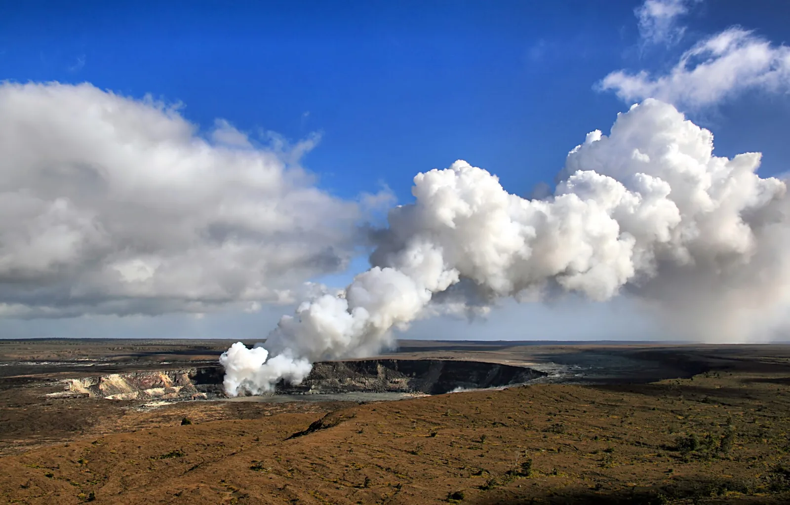
What you can see. The eruption site itself, on the crater floor, is closed. Viewpoints on the caldera rim inside Hawaiʻi Volcanoes National Park, including Uēkahuna, Kūpinaʻi Pali and Keanakākoʻi, are open. During a fountaining episode, the glow and fountains can be dramatic from the rim; between episodes, you will see a steaming crater. Viewpoints are busiest at sunset. For fewer people, go an hour or two before dawn or after 10pm.
How to catch an episode. Sign up for the free USGS Volcano Notification Service, which emails alerts, and watch the HVO livestream cameras. Stay near the park, in Volcano village or Hilo, if seeing lava is a priority, so that you can drive up at short notice. There is no guarantee: many visitors come during a pause.
Vog and air quality. Volcanic smog, or vog, forms when sulphur dioxide from the eruption reacts in the atmosphere. When winds are light or southerly, it can blanket the island, including Kona. It is a genuine respiratory risk for people with asthma, heart or lung conditions, as well as for young children and pregnant people. Check the state’s vog and air-quality updates, and stay out of areas where the park posts high sulphur dioxide warnings.
Things to do on the Big Island at a glance
| Experience | Region | 2026 cost | Book | Allow |
|---|---|---|---|---|
| Hawaiʻi Volcanoes National Park | Volcano | $30 per vehicle, valid 7 days | No | 1–2 days |
| Kīlauea Iki Trail | Volcano | Included in park entry | No | 2–3 hours |
| Chain of Craters Road | Volcano | Included in park entry | No | 3 hours return |
| Maunakea visitor station and stars | Saddle | Free | No | Evening |
| Manta ray night snorkel | Kona | $90–170, most $90–130 | Online, a week ahead | 2–3 hours |
| Kealakekua Bay | Kona | Guided tours vary | Authorised operators only for landing | Half a day |
| Puʻuhonua o Hōnaunau | Kona | $20 per vehicle, cards only | No | 2 hours |
| Hāpuna and Kohala beaches | Kohala | Free; parking fees may apply | No | Half a day |
| Pololū and Waipiʻo lookouts | North | Free | No | 1 hour each |
| ʻAkaka Falls | Hāmākua | State park fees for non-residents | No | 1 hour |
| Hilo town and farmers market | Hilo | Free | No | Half a day |
| Punaluʻu and Ka Lae | Kaʻū | Free | No | Half a day |
Kona or Hilo? Choosing your base
The single most important decision on the Big Island is where to stay. Drive times across the island are long, and the two sides have completely different weather and character. Most visitors do best splitting their stay, with most nights on the Kona or Kohala side and two or three nights in Hilo or Volcano.
| Kona and Kohala (west) | Hilo and Volcano (east) | |
|---|---|---|
| Weather | Dry and sunny most days | Frequent rain, lush and green; Volcano is cool at night |
| Beaches | The island’s best swimming beaches | Few swimming beaches |
| Accommodation | Resorts in Kohala, condos and hotels in Kona | Cheaper hotels, B&Bs and cabins |
| To the volcano | About 2.5 hours each way from Kona | 45 minutes from Hilo; minutes from Volcano village |
| Airport | Kona (KOA): more mainland flights | Hilo (ITO): mostly interisland |
| Highlights nearby | Manta rays, Kealakekua, Hōnaunau, coffee farms | Kīlauea, ʻAkaka Falls, farmers market, Hilo town |
| Best for | Beach holidays, families, snorkellers | Volcano lovers, hikers, budget travellers |
Our verdict. For a first visit of a week, stay four or five nights in Kona or Kohala and two or three nights in Volcano or Hilo. If you have only four days, base yourself in Kona and make one long volcano day, or fly into Hilo and base yourself on the east side if the volcano is your main reason for coming. Avoid trying to see Hawaiʻi Volcanoes National Park as a day trip from the Kohala resorts: that is five hours of driving for a few hours in the park.
Driving distances on the Big Island
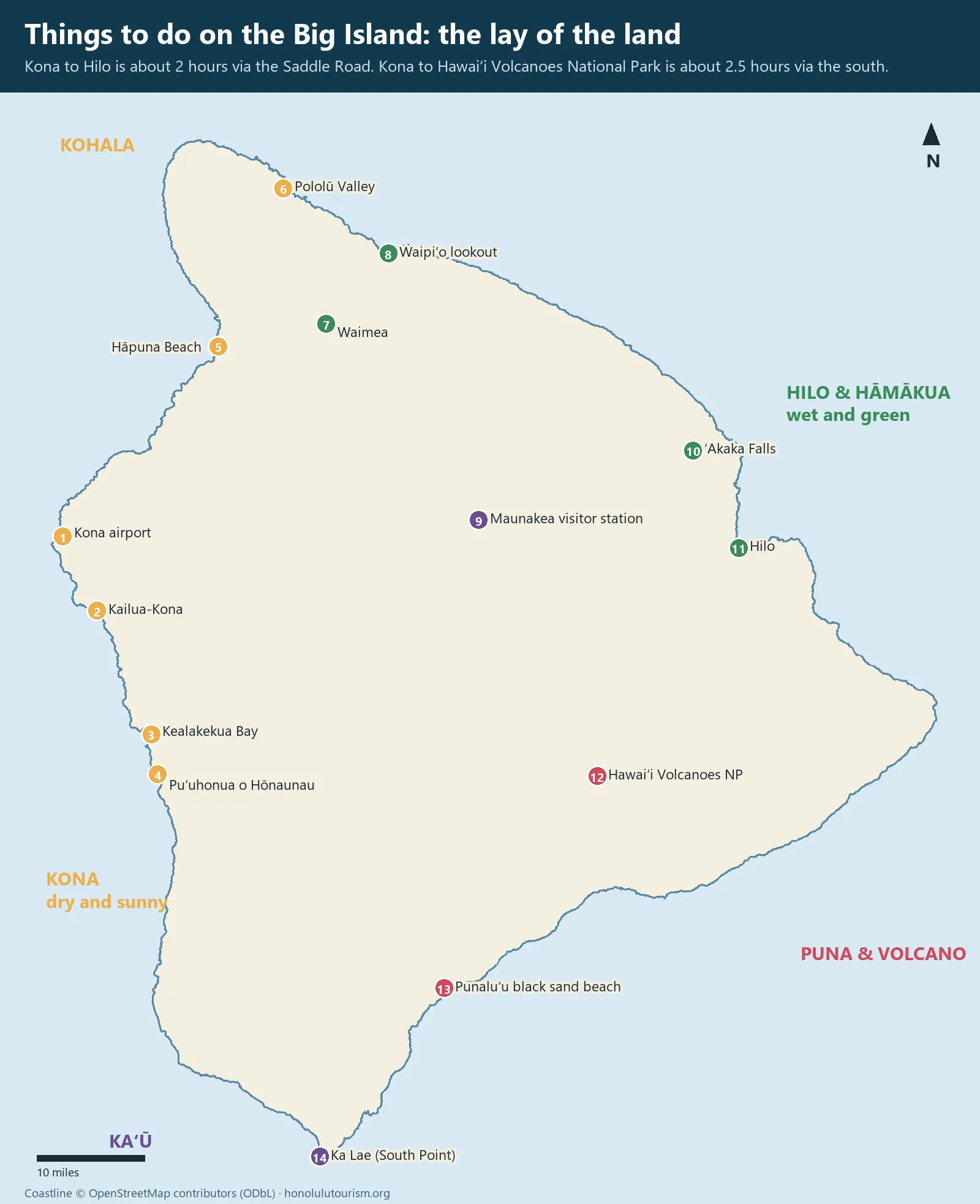
The distances below are approximate, for the most direct route in normal conditions without stops. The Big Island’s main loop road, the Hawaiʻi Belt Road, runs around the island for roughly 220 miles; the Daniel K. Inouye Highway, known as the Saddle Road, cuts across the middle between the two great volcanoes, Maunakea and Mauna Loa.
| Route | Distance | Drive time |
|---|---|---|
| Kona airport to Kailua-Kona | About 8 miles | 15 minutes |
| Kailua-Kona to Hāpuna Beach | About 33 miles | 45 minutes |
| Kailua-Kona to Waimea | About 40 miles | 1 hour |
| Kailua-Kona to Hilo via Saddle Road | About 75 miles | 2 hours |
| Kailua-Kona to Hawaiʻi Volcanoes NP via the south | About 95 miles | 2.5 hours |
| Kailua-Kona to Ka Lae (South Point) | About 70 miles | 1 hour 45 minutes |
| Hilo to Hawaiʻi Volcanoes NP | About 30 miles | 45 minutes |
| Hilo to ʻAkaka Falls | About 15 miles | 30 minutes |
| Hilo to Waimea via Hāmākua coast | About 55 miles | 1 hour 15 minutes |
| Kailua-Kona to Maunakea visitor station | About 65 miles | 1.5 hours |
| Full circle-island loop | About 220 miles | 6–7 hours without stops |
Fill up before long drives; fuel stations are few along the south coast and absent on the Saddle Road. Night driving on the Saddle Road can mean fog, rain and wandering animals. On the Hāmākua coast, the road has many curves and bridges. Do not plan to “do the loop” in a day and see anything worthwhile.
Hawaiʻi Volcanoes National Park
A UNESCO World Heritage Site and International Biosphere Reserve, Hawaiʻi Volcanoes National Park protects Kīlauea and much of Mauna Loa, the largest active volcano on Earth. Entry costs $30 per vehicle, valid for seven consecutive days, or $15 per person on foot or by bicycle; visitors aged 15 and under enter free. The park is open 24 hours. The summit area sits at about 4,000 feet and is often cool, damp and windy; bring a waterproof layer.
For Native Hawaiians, Kīlauea is the home of Pele, the goddess of volcanoes, and Halemaʻumaʻu is her sacred home. Do not take lava rocks, leave offerings of your own, or walk beyond barriers.
Cost: $30 per vehicle for 7 days; $15 on foot or bicycle · Hours: open 24 hours; visitor centre daytime · Book: no reservation needed · Drive: 45 minutes from Hilo, 2.5 hours from Kona · Allow: at least one full day, ideally two
Crater Rim Drive and the viewpoints
Start at the Kīlauea Visitor Center for current conditions, ranger talks and trail closures. Drive the open sections of Crater Rim Drive to the viewpoints over Halemaʻumaʻu, including Uēkahuna, the high point of the caldera rim. Stop at the steam vents and the Sulphur Banks, where volcanic gases rise through the ground; stay on the boardwalk. Nāhuku, the Thurston Lava Tube, is a short walk through rainforest and a lit lava tube.
Kīlauea Iki Trail
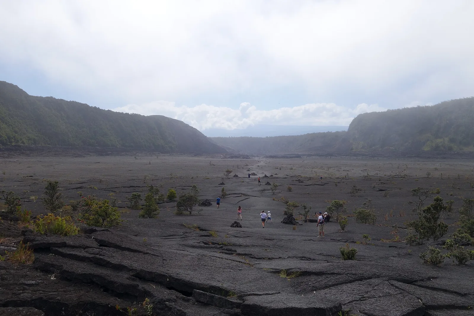
The best day hike in the park. The loop of about three to four miles descends through rainforest onto the floor of Kīlauea Iki, a crater that held a lava lake during an eruption in 1959, crosses the still-steaming crust, and climbs back to the rim. It takes two to three hours. The crater floor is hot and exposed on sunny days; carry water and sun protection.
Chain of Craters Road
This road descends about 3,700 feet over roughly 19 miles, from the summit to the coast, passing pit craters, lava flows of different ages and the Puʻuloa petroglyph field. It ends at the Hōlei Sea Arch, where the road was cut by lava. There is no food, water or fuel along the road; fill up in Volcano before you set off. Allow about three hours for the round trip with stops.
Volcano safety
- Stay on marked trails and behind barriers. Cracks and crater edges can collapse without warning.
- Volcanic gases are hazardous, especially for people with heart or respiratory conditions, pregnant people, infants and young children. Follow the park’s gas warnings.
- Carry water, a rain jacket and a warm layer. Summit weather changes quickly.
- Bring a torch for early-morning or evening viewing, and park only in designated areas.
- Follow closures during active episodes; rangers close areas for good reasons.
Maunakea
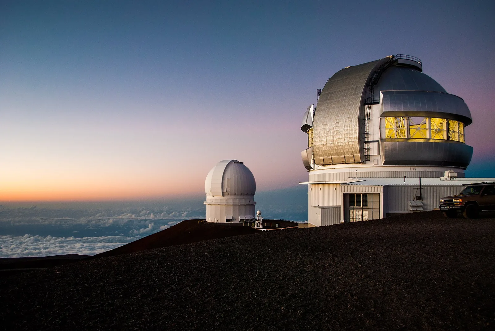
At 13,803 feet, Maunakea is the highest point in Hawaiʻi and, measured from its base on the ocean floor, the tallest mountain on Earth. Its summit hosts some of the world’s most important astronomical observatories. It is also the most sacred mountain in Hawaiian tradition, a realm of the gods, and its future has been the subject of deep and sometimes painful debate. Visit it with respect.
The Maunakea Visitor Information Station, at about 9,200 feet, is open daily from 9am to 9pm. It is the practical destination for most visitors: the sunset is spectacular, the stars afterwards are extraordinary, and the altitude is high enough. Above the visitor station, the road to the summit is steep and partly unpaved, and four-wheel drive (used in low range on the descent) is required. Most rental car agreements prohibit taking cars up to the summit. Children under 13, pregnant people and anyone in poor health should not go above the visitor station because of altitude sickness risk.
Clean your shoes and vehicle before visiting, to avoid carrying invasive species onto the mountain. Bring warm clothing: it is often near freezing after sunset, even in summer. Several operators run sunset and stargazing tours with 4WD vehicles and parkas.
Cost: free · Hours: visitor station 9am–9pm daily · Book: no; tours need booking · Drive: about 1.5 hours from Kona, 1 hour from Hilo; half a tank of fuel minimum · Allow: an evening, including 30 minutes at the visitor station to acclimatise
The Kona coast
Kona is the sunny, dry west side of the island, with Kailua-Kona town, coffee farms on the slopes above, and a coastline of lava rock, small beaches and some of Hawaiʻi’s best snorkelling.
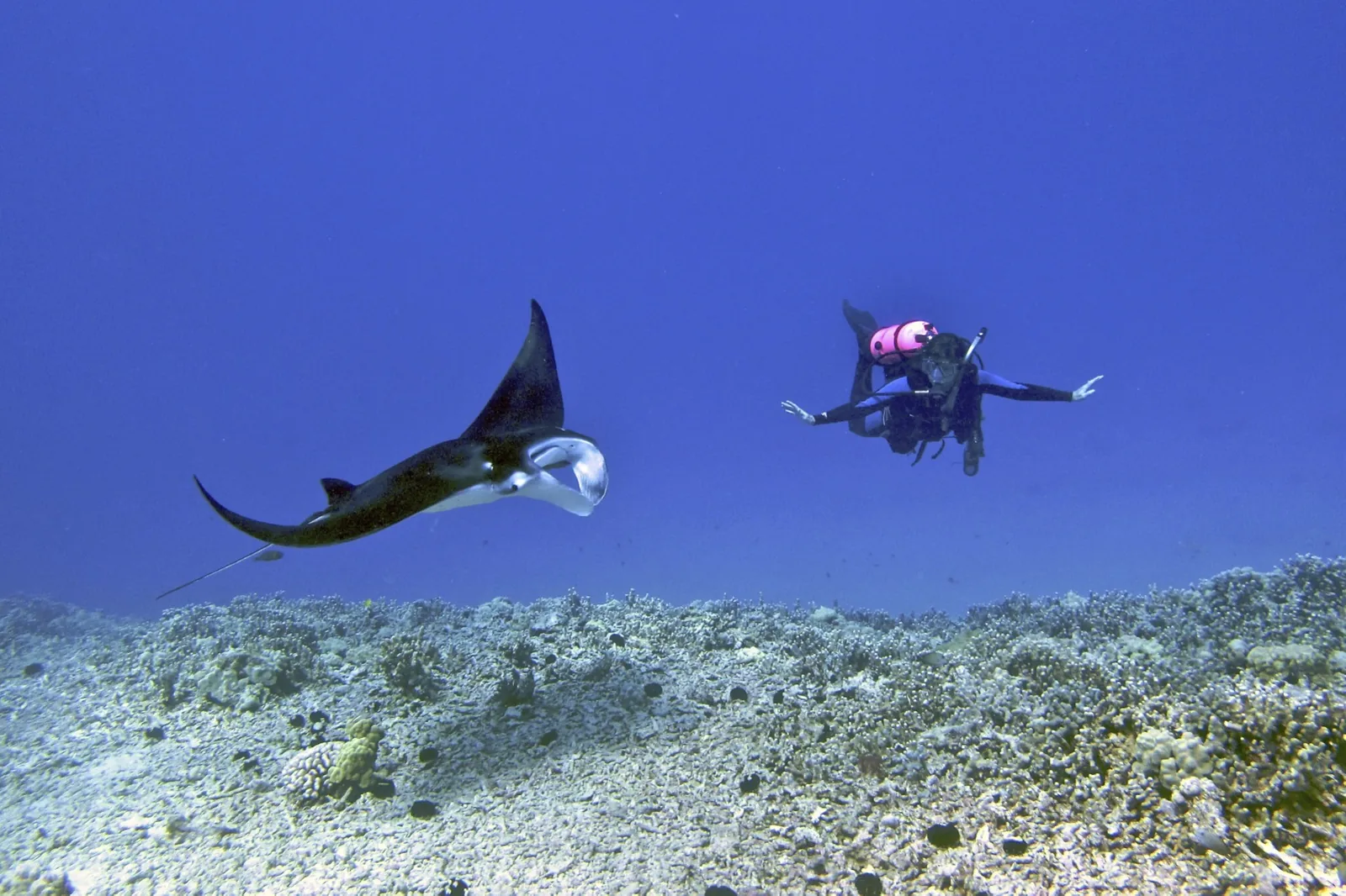
Manta ray night snorkel
After dark, boats anchor off the Kona coast and shine lights into the water. Plankton gathers in the light, and manta rays, some with wingspans of more than ten feet, glide and somersault just beneath the surface to feed. Snorkellers float holding a lit board while divers watch from below. It is one of the most extraordinary wildlife experiences in Hawaiʻi. Prices run $90–170 per adult, with most trips $90–130. Do not touch the mantas. If you are prone to seasickness, take something before boarding, and tell the crew if you are not a confident swimmer.
Cost: $90–170 per adult · Hours: evening departures · Book: online, a week ahead · Drive: Honokōhau Harbor or Keauhou, 15 minutes from Kailua-Kona · Allow: 2–3 hours
Kealakekua Bay
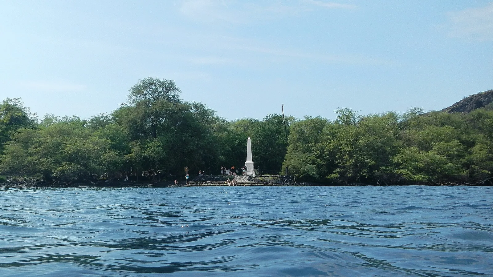
A Marine Life Conservation District with crystal-clear water, spinner dolphins and superb reef snorkelling, particularly near the white obelisk that marks where Captain James Cook was killed in 1779. The bay is also a place of great significance in Hawaiian history, and Hikiau Heiau stands at its northern end.
Access is controlled. Landing a kayak or any vessel at Kaʻawaloa Flat, beside the monument, requires a permit that is available only by going with one of the DLNR-authorised guided tour companies. If you rent a kayak to paddle the bay, confirm that the vessel carries a valid transit permit. Boat snorkel tours from Kona are the easiest option. A steep, hot trail also leads down to Kaʻawaloa from the road above; it is a demanding hike back up. Stay at least 50 yards from spinner dolphins, which rest in the bay during the day.
Cost: tours vary · Hours: morning, when the water is calmest · Book: authorised operators only for landing · Drive: 30 minutes south of Kailua-Kona · Allow: half a day
Puʻuhonua o Hōnaunau National Historical Park
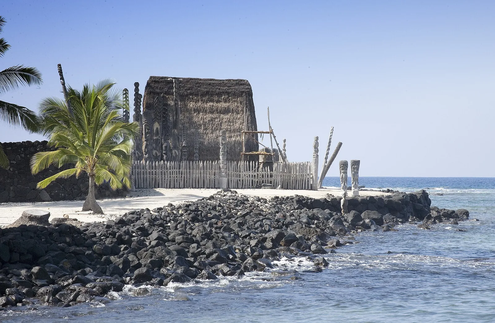
In old Hawaiʻi, anyone who broke a kapu (sacred law) could be put to death, unless they reached a puʻuhonua, a place of refuge, where they could be absolved. The puʻuhonua at Hōnaunau, with its massive stone wall, reconstructed temple and carved kiʻi images standing guard over the water, is one of the most atmospheric historic sites in Hawaiʻi. Walk the self-guided trail, and look for turtles resting on the lava. Entry is $20 per vehicle, $10 on foot, and the park accepts cards only.
Next door, Hōnaunau Bay, known as Two Step for its natural lava-ledge entry, is one of the best shore snorkelling spots in Hawaiʻi. Enter carefully on calm days only, and do not stand on the coral.
Cost: $20 per vehicle, $10 per walk-in; cards only · Hours: daytime · Book: no · Drive: 40 minutes south of Kailua-Kona · Allow: 2 hours, plus snorkelling
Kona coffee, Kailua-Kona and beaches
The slopes above Kona grow some of the world’s most famous coffee on small family farms. Many farms offer tours and tastings; ask what is included before you go, and buy direct. Look for “100% Kona” on the label, as blends may contain only a small percentage.
In Kailua-Kona town, Huliheʻe Palace, a summer residence of Hawaiian royalty, sits on the seafront. South of town, Kahaluʻu Beach Park is a sheltered, beginner-friendly snorkelling spot with many turtles; keep 10 feet away. Magic Sands (Laʻaloa) is a popular bodyboarding beach whose sand can disappear in high surf. North of the airport, the white-sand beaches of Kekaha Kai State Park, including Kua Bay, are gorgeous but exposed, with strong shorebreak on some days.
Kohala
North of Kona, the Kohala Coast has the island’s finest white-sand beaches and its big resorts, set among black lava fields. Further north, the old Kohala volcano rises into green ranchland and plunges into deep valleys.
Hāpuna and Kaunaʻoa
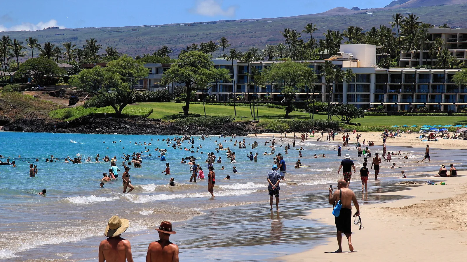
Hāpuna Beach State Recreation Area has a long, wide white-sand beach, lifeguards and, in summer, calm swimming. Winter swells can bring powerful waves and currents. Nearby Kaunaʻoa (Mauna Kea Beach) is a perfect crescent; public parking is limited and issued at the resort gate, so arrive early.
Puʻukoholā Heiau and North Kohala
Puʻukoholā Heiau National Historic Site protects a great temple built by Kamehameha I in 1790–91, a key step in his unification of the Hawaiian Islands. It is free, and a short walk gives a good view of the heiau’s massive stone terraces. Visitors may not enter the heiau itself.
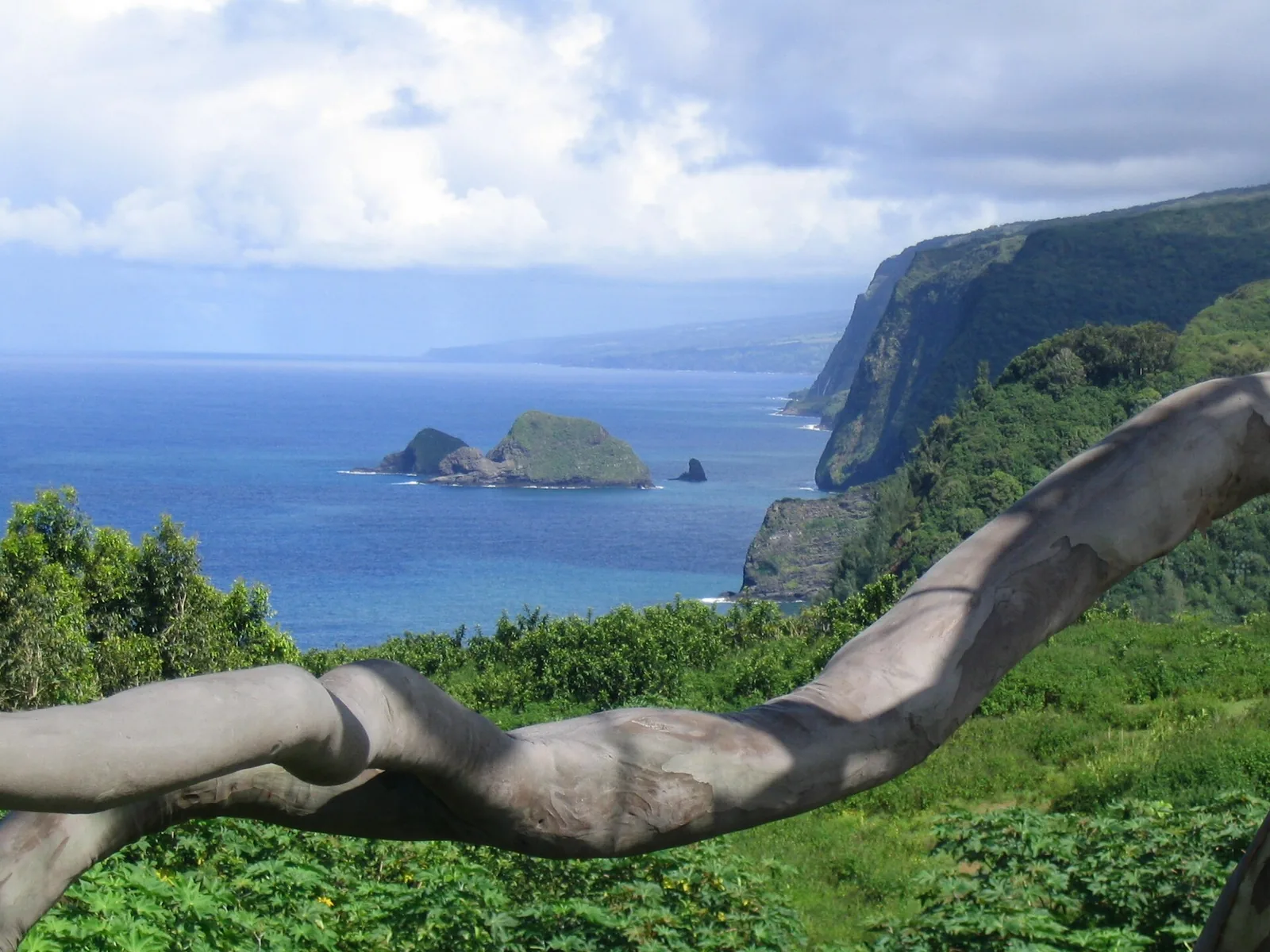
In North Kohala, the small towns of Hāwī and Kapaʻau have cafés and galleries, and Kapaʻau is home to the original statue of Kamehameha I, near his birthplace. The road ends at the Pololū Valley lookout, with views down to a black-stone beach and along towering sea cliffs. The trail down is steep, rocky and slippery; the ocean at the bottom is dangerous for swimming. Respect community stewardship signs and parking rules.
Waimea and Waipiʻo
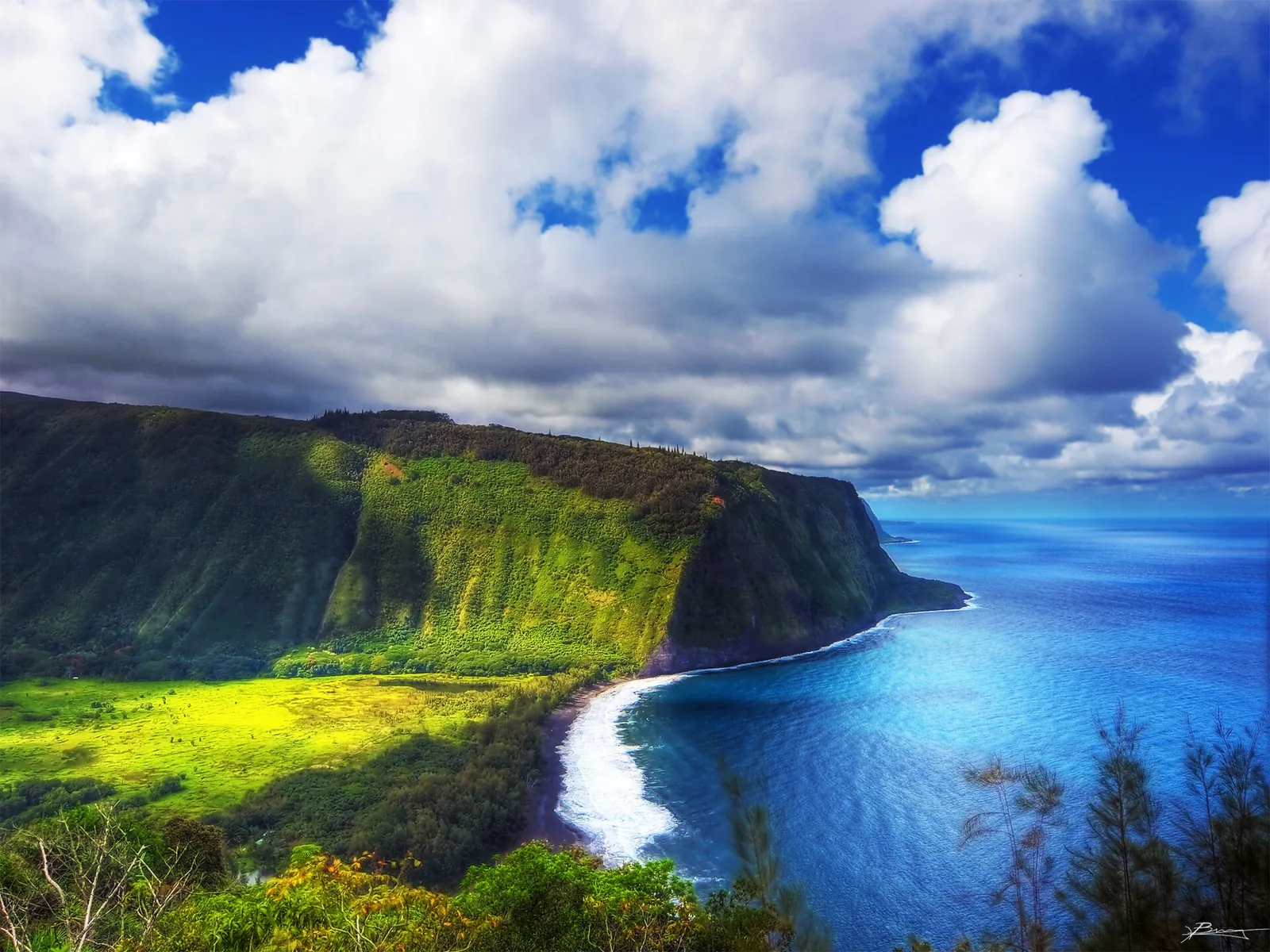
Waimea, up in the cool green hills, is paniolo (Hawaiian cowboy) country, with ranches, a good farmers market and excellent restaurants. From Waimea, the Hāmākua coast road leads east to the Waipiʻo Valley lookout, above one of the most beautiful and culturally important valleys in Hawaiʻi. The steep road down into the valley has been restricted to most visitors in recent years for safety and community reasons. Enjoy the view from the lookout, and check County of Hawaiʻi notices before planning anything more.
Hilo and the Hāmākua coast
Hilo is the island’s old capital and its most authentically local town, with a curving bayfront, wooden storefronts, Japanese-influenced gardens and a relaxed, rainy charm. It is also one of the wettest cities in the United States. Bring an umbrella and embrace it: the rain is why everything is so green.
Hilo Farmers Market. Held downtown, with the biggest markets on Wednesdays and Saturdays. Look for tropical fruit, flowers and local snacks.
Rainbow Falls (Waiānuenue). A short walk from the car park to a waterfall in the town’s outskirts, best in the morning, when rainbows form in the spray. It is free.
Liliʻuokalani Gardens and Coconut Island. Japanese-style gardens on Hilo Bay, with a footbridge to a small island park.
Pacific Tsunami Museum. Hilo was devastated by tsunamis in 1946 and 1960. This small museum tells the story powerfully.
ʻImiloa Astronomy Center. A museum and planetarium connecting Hawaiian voyaging and cultural knowledge with the astronomy on Maunakea. It is the best rainy-day option in Hilo.
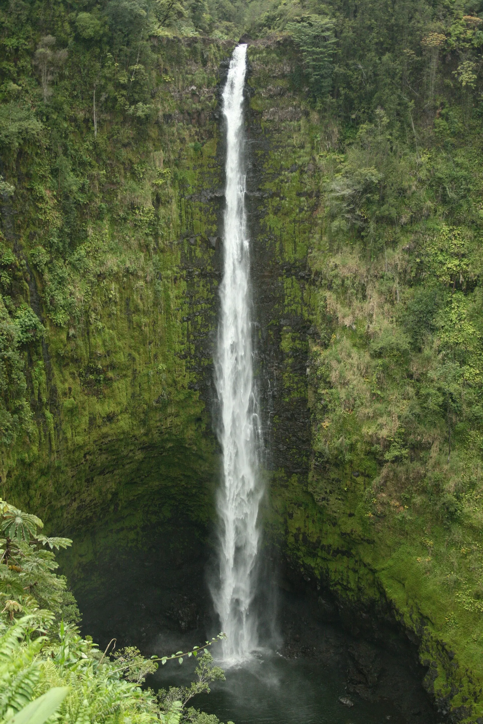
ʻAkaka Falls State Park. North of Hilo, a paved loop through rainforest leads to the 442-foot ʻAkaka Falls. Non-residents pay state park entry and parking fees. Allow an hour.
Merrie Monarch Festival. The world’s most prestigious hula competition fills Hilo every spring. The 64th festival runs from 28 March to 3 April 2027. Competition tickets are extremely hard to get, but the festival parade through downtown Hilo and many daytime craft fairs and performances are free. Book accommodation very early.
Puna and Kaʻū: the south
Punaluʻu Black Sand Beach. A striking beach of black volcanic sand fringed with coconut palms, where green sea turtles often rest on the shore. Stay 10 feet away. Swimming is often unsafe because of currents and cold freshwater springs. Do not take any black sand: it is illegal, and the beach cannot replace it.
Ka Lae (South Point). The southernmost point of the United States, a windswept headland where Polynesian voyagers are believed to have first landed. People jump from the cliffs here; it is dangerous, and currents offshore are fierce. We would not.
Papakōlea (Green Sand Beach). One of only a handful of green-sand beaches in the world, coloured by olivine crystals. It is reached by a hot, exposed walk of about two and a half to three miles each way from the South Point road. Local residents offer rides in trucks along the rutted tracks; they are unregulated and damage the landscape. Walk if you can, go early, and carry plenty of water. Do not take sand.
Puna. The eastern district, around Pāhoa, is a place of lava-covered land, small communities and tropical forest. The 2018 eruption of Kīlauea’s lower East Rift Zone destroyed more than 700 homes and buried popular spots including the Kapoho tide pools. Visit with sensitivity; this is a community that lost a great deal.
More outdoor things to do on the Big Island
Hikes beyond the national park
Pololū Valley Trail. A steep, rocky descent of about 400 feet from the lookout to a boulder beach and ironwood grove. It takes around 20 minutes down and longer back up, and it is slippery after rain. The surf at the bottom is dangerous; do not swim.
Puʻu Huluhulu. A short, easy loop to the top of a forested cinder cone beside the Saddle Road, opposite the turn-off for Maunakea. It is a good leg-stretch that doubles as altitude acclimatisation before driving up to the visitor station, with views of both great volcanoes on a clear day.
Kaumana Caves. A county park on the edge of Hilo where you can climb down into a lava tube formed by an 1881 flow from Mauna Loa. Bring a torch, sturdy shoes and a helmet if you have one; the floor is uneven and wet.
Kalōpā State Recreation Area. Quiet native forest trails in the uplands above the Hāmākua coast, cool and shaded, with a nature loop suitable for families.
On any Big Island hike, carry more water than you expect to need, and remember that weather at altitude changes quickly. Lava fields are hot, sharp and disorienting; stay on the marked route, often indicated by stacked-stone ahu cairns placed by rangers (do not add your own).
On the water
Whale watching. From roughly December to March, humpback whales can be seen off the Kona and Kohala coasts. Boat tours run from Honokōhau Harbor, and shore sightings are common from Kohala’s beaches and resort walkways in the morning. Vessels must keep 100 yards from humpbacks.
Sport fishing. Kona is one of the world’s great big-game fishing grounds, with deep water close to shore, and has hosted international billfish tournaments for decades. Charter boats leave Honokōhau Harbor daily.
Snorkelling from shore. Beyond Two Step and Kahaluʻu, the calm coves of the Kohala Coast, such as those near the resorts at ʻAnaehoʻomalu and Puakō, have good reef snorkelling in the morning. Check conditions, and never swim alone.
Dolphins. Spinner dolphins rest during the day in Kona’s bays. Federal rules prohibit swimming with them or approaching within 50 yards, including by kayak or paddleboard. Avoid any tour that promises swimming with dolphins.
Things to do on the Big Island with children or in the rain
The Big Island is a superb family destination for children old enough to enjoy a road trip. The volcano is the obvious highlight: Nāhuku lava tube, the steam vents and a walk across Kīlauea Iki crater capture most children’s imaginations, and the park’s Junior Ranger programme gives them something to aim for. Kahaluʻu Beach Park, with its shallow, sheltered water and turtles, is the easiest first snorkel. ʻImiloa Astronomy Center’s planetarium in Hilo is excellent for curious minds, and Puʻuhonua o Hōnaunau’s carved kiʻi and turtle-lined shore bring Hawaiian history to life.
Keep drives short. Base yourself on one side of the island at a time, and break long journeys with stops at beaches or waterfalls. Children under 13 should not go above the Maunakea visitor station, and young children are more vulnerable to vog and volcanic gas.
If it rains, as it often does in Hilo, head for ʻImiloa, the Pacific Tsunami Museum, the Hilo Farmers Market’s covered stalls or a drive to the dry Kona side, where it is very often sunny. Heavy rain is not the day for waterfall pools, stream crossings or Pololū. It is a fine day for the national park’s visitor centre and short boardwalk walks, with a waterproof jacket.
Staying safe on the Big Island
Ocean. Drowning is the leading cause of injury death for visitors to Hawaiʻi, and snorkelling is involved in close to a third of those deaths. Many Big Island beaches have no lifeguards. Swim at guarded beaches where you can, never snorkel alone, and stop and float if you feel breathless. Our snorkelling safety guide explains the risks.
Altitude. The Maunakea summit is at 13,803 feet, and Mauna Loa’s observatory road climbs above 11,000 feet. Altitude sickness can affect anyone. Acclimatise at the visitor station, do not scuba dive within 24 hours before going high, and descend if you feel dizzy, confused or short of breath.
Vog and volcanic gas. Check air-quality updates, particularly if you have asthma or heart or lung conditions.
Flash floods. On the wet east side, streams can rise in minutes. Never cross flooded streams or swim in waterfall pools after heavy rain. Hawaiʻi’s Department of Health also advises staying out of the ocean for 72 hours after heavy rain near stream mouths.
Wildlife and culture. Keep 10 feet from turtles, 50 feet from monk seals and 50 yards from spinner dolphins. Respect kapu signs and heiau. Do not take lava rock or sand.
Eating on the Big Island
The Big Island’s food is farm- and ocean-driven: Kona coffee, macadamia nuts, grass-fed beef from Waimea’s ranches, fresh ahi poke, vanilla and cacao. Farmers markets in Hilo, Waimea and Kona are the best places to taste the island.
Hilo is also where the loco moco (rice, a hamburger patty, a fried egg and brown gravy) is generally said to have been invented, in 1949. It is a much-loved local-style dish, part of the plantation-era mix of cooking traditions, but it is not traditional Native Hawaiian food, which centres on kalo, fish and imu-cooked pork. Our Honolulu food guide explains the difference.
Where to stay
Kailua-Kona. Condos, hotels and restaurants, close to the airport, manta rays and coffee country. Good value and convenient.
Kohala Coast. The island’s big resorts and best beaches. More expensive, and further from the volcano.
Waimea. Cool, green and central, with fewer beach days.
Hilo. The most affordable base, with a real town feel and easy access to the volcano and waterfalls.
Volcano village. Rainforest cabins and B&Bs minutes from the national park, ideal for early-morning or late-night eruption viewing. Cool and damp at night.
Book early for Merrie Monarch week, the October Ironman World Championship in Kona and the Christmas holidays.
Sample itineraries
Four days
Fly into Kona. Day one: beach and a manta ray night snorkel. Day two: Kealakekua Bay snorkel tour and Puʻuhonua o Hōnaunau. Day three: an early drive south via Punaluʻu to Hawaiʻi Volcanoes National Park, a night in Volcano, and evening viewing at the caldera rim. Day four: Kīlauea Iki at dawn, then back to Kona across the Saddle Road, with a stop at the Maunakea visitor station if time allows.
Seven days
Kona for three nights (manta rays, Kealakekua, Hōnaunau, coffee farms, a Kohala beach day), then drive to Waimea and along the Hāmākua coast via the Waipiʻo lookout and ʻAkaka Falls to Hilo. Spend two nights in Hilo or Volcano for the national park, and two nights back on the Kohala Coast, with a sunset and stargazing evening on Maunakea.
Ten days
Add North Kohala and Pololū, a Chain of Craters Road day, a morning at the Hilo Farmers Market and ʻImiloa, and a day in Kaʻū with Ka Lae and the walk to Papakōlea.
When to visit
The Kona side is dry and sunny all year. Hilo is wettest from about November to April. Winter brings big surf to north- and west-facing shores and, in some years, snow on Maunakea and Mauna Loa. Humpback whales are visible off Kona and Kohala from roughly December to March. Spring brings the Merrie Monarch Festival to Hilo; October brings the Ironman to Kona. September and May are quiet, pleasant months with lower prices. See our guide to the best time to visit Hawaiʻi for month-by-month detail, and our Hawaiʻi trip planning guide for flights and budgets.
What to skip
Visiting the volcano as a day trip from Kohala. Spend at least one night in Volcano or Hilo.
Driving a rental car to the Maunakea summit. It is prohibited by most rental agreements and dangerous without proper 4WD. Stop at the visitor station or join a tour.
Paying for a truck ride to Green Sand Beach. Walk, or skip it.
Taking lava rock, black sand or green sand. It is illegal and culturally disrespectful.
Chasing lava outside the park. Follow official closures; do not trespass on private land or near active flows.
If you are combining islands, the Big Island pairs well with Oʻahu for history or with Maui for whale season. Our island comparison scores all four.
For a greener, quieter contrast to the Big Island, see our guide to Kauaʻi, including Hāʻena reservations and how to see the Nāpali Coast.
Frequently Asked Questions
What are the best things to do on the Big Island?
Spend at least a full day in Hawaiʻi Volcanoes National Park, including the Kīlauea Iki Trail and the caldera viewpoints. Take a manta ray night snorkel off Kona, snorkel Kealakekua Bay, visit Puʻuhonua o Hōnaunau, watch sunset and stars from the Maunakea visitor station, see ʻAkaka Falls and Hilo, and relax on Hāpuna Beach. Split your stay between Kona and Hilo or Volcano.
Can you see lava on the Big Island in 2026?
Sometimes. Kīlauea has been erupting in episodes at its summit since December 2024, with 54 fountaining episodes by mid-September 2026. Episodes usually last under 12 hours, with pauses of two weeks or more, so seeing lava is a matter of timing. The eruption site is closed, but caldera-rim viewpoints in the national park are open. Follow USGS Hawaiian Volcano Observatory updates.
Should I stay in Kona or Hilo?
Most visitors should do both. Kona and Kohala are dry and sunny, with the best beaches, snorkelling and resorts. Hilo and Volcano are wetter and greener, cheaper, and far closer to Hawaiʻi Volcanoes National Park. A typical week works well with four or five nights on the Kona side and two or three nights near the volcano.
How much does Hawaii Volcanoes National Park cost?
Entry to Hawaiʻi Volcanoes National Park costs $30 per private vehicle, valid for seven consecutive days. Visitors on foot or bicycle pay $15 per person, and those aged 15 and under enter free. No reservation is needed, and the park is open 24 hours. Puʻuhonua o Hōnaunau National Historical Park charges separately, at $20 per vehicle.
Can you drive to the top of Mauna Kea?
Above the Maunakea Visitor Information Station, at about 9,200 feet, the summit road is steep and partly unpaved, and four-wheel drive is required. Most rental car agreements prohibit it. Children under 13, pregnant people and those in poor health should not go above the visitor station. Most visitors watch sunset and stars from the station, open 9am to 9pm, or join a 4WD tour.
How long does it take to drive around the Big Island?
The full circle-island loop is about 220 miles and takes six to seven hours of driving without stops. Doing it in one day leaves little time to see anything. Kona to Hilo takes about two hours via the Saddle Road, and Kona to Hawaiʻi Volcanoes National Park about two and a half hours via the south. Plan to stay on both sides of the island.
Photo Credits
- Map of things to do on the Big Island: honolulutourism.org, coastline data © OpenStreetMap contributors (ODbL)
- Kīlauea Iki crater: Relativity, CC BY-SA 4.0
- Halemaʻumaʻu gas plume, 2008: Brocken Inaglory, CC BY-SA 3.0
- Maunakea observatories at sunset: Michail Babchuk, CC BY-SA 4.0
- Manta ray off Kona: Steve Dunleavy, CC BY 2.0
- Captain Cook Monument, Kealakekua Bay: Robert Linsdell, CC BY 2.0
- Puʻuhonua o Hōnaunau: Carol M. Highsmith, public domain
- Hāpuna Beach: Larry D. Moore, CC BY 4.0
- Pololū Valley lookout: Mickaw2, public domain
- ʻAkaka Falls: Diego Delso, CC BY-SA 3.0
- Waipiʻo Valley lookout (featured image): Paul dexxus, CC BY 2.0